Translate

Powered By Blogger

Saturday, January 16, 2016

POST 1516; FEDERAL WAY, WASHINGTON; 01-16-2016


We have once gain met with unwanted challenge(s) ... all having to do with our desire to help others

Of the 4+ years walking, we Volunteered eight months to help County and Residents of the OUTER BANKS, North Carolina to help recover from HURRICANE IRENE.  Details of our efforts are posted in prior blog updates, which included loss of SPIA's transmission.  We replaced the loss with a USED transmission @ something more than $2,500.00.  That transmission is now giving us fits , and may preclude continuing our SAGA.

We just concluded one year fulfilling the request of DALLAS to "care take" him and his home / property upkeep to - as DALLAS puts it -  stay alive in his battle against DIABETES.

It has been our pleasure to be of help to others, for which we have not suggested nor received  consideration.  MANY, however, have helped along the way ... for which SAM, SPIA and ME are forever grateful

We set out some 5 years ago to see if an old man with NO assets and without formal outside assistance could not only survive, but somehow contribute to society.

We have succeeded beyond our wildest visibility, as shared by virtue of this Blog's testament.

We must now face reality.  We have "donated" something in excess of $10,000.00 from my personal Line of Credit with American Express (Balance due is in excess of $5,000.00)... and are faced with maintenance demands of SPIA ... for which funds are not immediately available.

Do not jump to conclusions ...

This missive is NOT an appeal or plea for any but understanding of limitations incumbent upon our continued effort(s).  We WILL continue (!) albeit a bit constrained ...

We have REFUSED ALL "entitlements" from Uncle SAM  - such as FOOD STAMPS, etc.

SOCIAL SECURITY is our ONLY income since 1995 ... a so-called entitlement ...  (NOT SO:  I have paid my SOCIAL SECURITY since I obtained my Social Security Card at the age of nine (9) years old).  Our Government has "misappropriated" my SSC. while charged to invest, protect and make it available to me in my old age.  Social Security is NOT AN ENTITLMENT.  SSC is MY MONEY, invested since 1944 for care by Uncle SAM ... this promised by President ROOSEVELT and our CONGRESS.


SEATTLE, Washington, USA ... The city of my birth ... on my MATERNAL GRANDMOTHER's Dining Room Table ... (Yes, I visited that stately home on CAPITAL HILL, expressing appreciation to the current owners for allowing ME a private moment in the room of my birth.


SKAGIT RIVER VALLEY - with our Volcano Mount BAKER in center distance - some 100 miles distant - Purported to be the largest concentration of commercial TULIPs outside of the country of HOLLAND.

We will shortly visit the city of LA CONNER, Washington ... a "destination" by vehicle or yacht.


SKAGIT RIVER VALLEY Estuary.

Images taken while driving, so may be a bit katiwampus.


LA CONNER CHANNEL ...SHIP CANAL connecting upper PUGET SOUND with that part of Central PUGET SOUND lying East of America's Second Largest Island ... WHIDBEY ISLAND.


Cross over the bridge to reach the local Indian village.


A 40 - Foot Yacht ... twin of PAUL G's Yacht which he rescued and reconstructed after being severely burned in the BELLINGHAM Shipyard fire.

  As an Historical Note ... This factory built many of the SOUTH VIETNAM River Boats  which fought in that unpopular War.


LA CONNER, Washington


LA CONNER Homes on the cliff overlooking the City and Canal.


Downtown LA CONNER on a wintry "off" Tourist day.


SEATTLE comes into view from I-5.


\
SEATTLE's Lake UNION, and distant downtown SKY SCRAPERS.  SPACE NEEDLE in CENTER with OLYMPIC MOUNTAINS in the FAR DISTANCE.


* * * * * * * * * *

Will visit my SON, RONALD in the City of FEDERAL WAY, Washington this evening.  Battling DIABETIS, Ron has , as have so many, for many years, been battling DIABETES.  We both are eager to spend some time together.

We may go on to visit my Daughter, MONICA, living near BURNS, Oregon.  Among many achievements, MONICA has for years maintained the buildlngs of the MALHUER RESERVE recently invaded by gun toting farmers.  Monica was working at the Preserve Buildings when the perpetrators arrived to take control of the Preserve.  Monica was allowed to peacefully leave, but had to leave her personal equipment.

Monica has little time for such antics, so has gone on to execute one of her other non-related social responsibilities.


Tuesday, January 12, 2016

POST 1515; BELLINGHAM, WASHINGTON; 01-12-2016


It is one week since our previous Post.

Our intention to climb HURRICANE RIDGE was denied by the National Park Service because of the great number of visitors coupled by heavy snow on the roadway and limited parking space at the top.  Vehicles waiting at PORT ANGELES were held at the bottom ... vehicles allowed up the mountain only as vehicles descended to make room for new visitors.  Then too. all vehicles were required to have Snow Chains to climb the steep twisting roadway ... which we did not have.

Rain and intermittent snow flakes remained for the past week, making photography marginal at best.

We continued our journey, arriving as the overcast skies darkened over BELLINGHAM.


\


Looking South from PORT ANGELES WAL-MART, where we spent the final night of our Journey from West Virginia to Washington STATE following the outermost roadway ... the roadway closest to the Ocean ( or USA Border with MEXICO) ... we look longingly to HURRICANE RIDGE in the shrouded morning light.


A short drive through PORT ANGELES.  Not representative, however, as PORT ANGELES is a large busy city.  A few images were obtained - and posted here - , but it has rained hard and continuous making picture taking a bit difficult.


Anchored in the Inner Harbor - on the Shore Side of the 1/4 mile long RIP RAP BREAKWATER - is a large OIL CARRIER.  Much of the ALASKA NORTH SLOPE CRUDE OIL is carried by such ships to PUGET SOUND where the oil is off-loaded at one of the many REFINERIES, processed (REFINED) and shipped primarily by Pipe Line across America.


Situated on the STRAITS OF SAN de FUCA, PORT ANGELES is home base to U.S. COAST GUARD SHIPS and HELICOPTERS.


The CONTAINER SHIP pictured above is actually ten or so miles away, transiting the STRAITS OF SAN de FUCA.  From there, that ship has the option to turn South to a United States Seaport, or North to a Seaport in BRITISH COLUMBIA, CANADA.

From 1962 until 1980, I was employed as CONTRACTS MANAGER for sequentially :  LOCKHEED - CRANE DIVISION, Seattle; then STAR IRON and STEEL, Tacoma; and finally Germany's KRUPP, GMBH - KRUPP INTERNATIONAL DIVISION, New York.  One of our primary items designed, manufactured and Installed in Seaports around the World were "CONTAINER CRANES" which Load and Unload the CONTAINERS seen on the DECK of the ship above.


From PORT ANGELES, we drove through a pounding RAIN to the city of PORT TOWNSEND, Washington, a city at the North East Corner of the OLYMPIC PENINSULA at the juncture of the STRAITS OF SAN de FUCA and PUGET SOUND.

From PORT TOWNSEND, a WASHINGTON STATE FERRY carries Vehicles and  Foot Passengers to WHIDBEY ISLAND, WASHINGTON - after LONG ISLAND, NEW YORK, the second largest Island in the Continental UNITED STATES.


The PORT TOWNSEND PIER where the WASHINGTON STATE FERRY loads and unloads Vehicles and Passengers.


PORT TOWNSEND is built on two levels .  The image above shows BOTH levels

The PIER for the Car FERRY is behind the CAMERA.

The CLIFF consists of the CLAY found on the PACIFIC OCEAN Coastline stretching some 800 miles to SAN FRANCISCO.


PORT TOWNSEND was once a major shipping Seaport.  In mid 1800s, the Continental Railroad construction STOPPED in SEATTLE, which became the center of International Ocean Shipping.

Beautiful PORT TOWNSEND has retained its Seaport vibrancy from 150 years ago, being a "Destination" for private Yachts and vehicles from the "Inland Sea"


FERRY about to load for the 40 minute run to FORT CASEY on WHIDBEY ISLAND.

The World's largest OCTOPUS ... measuring some 32 feet in DIAMETER ... was, I am informed, captured at the WHIDBEY ISLAND FORT CASEY FERRY DOCK.

Largest OCTOPUS I have seen, was 19 foot in DIAMETER, taken by hand by a "FREE DIVER" during a competition  in 100 foot deep waters under the OLD BRIDGE "GALLOPING GIRDY" in the city of TACOMA, some 60 miles South of SEATTLE.

GALLOPING GIRDY fell into PUGET SOUND in 1935 after being subjected to high winds.  Bridge DESIGN created a "FOIL' ... subjected to high winds, the FOIL began to "FLY" causing the bridge to twist and jump about until is fell. 

There is a video of the bridge in its Death Throes ... vehicles were caught on the bridge in the video.  The vehicles also fell.

As an aside, I, not yet one year old, crossed GALLOPING GIRDY with my parents some 30 minutes before her destruction.  We lived some 30 miles from the bridge.


LOPEZ ISLAND is in the Middle Ground.  WHIDBEY ISLAND is in the FOREGROUND


LOPEZ and WHIDBEY ISLANDs together are two of 172 islands making up the SAN JUAN ARCHIPELAGO.  Crystal Clear Waters, the SAN JUANs are home to three families of ORCA "KILLER WHALES" (about 50 individuals)
 

F-18A U.S. NAVY Standard CARRIER FIGHTER JET on "FINAL" Approach to land at Whidbey Island, a long time A-6 Training Base.


TREES in the front yard of "BOB",  Sailing Friend of many years, with whom we are staying for a few days in BELLINGHAM.

Bob!  of many PHD type friends I asked for guidance while building SAM, only BOB offered to help; and has from the beginning of our Senior Walk, been "THERE" for us.

Thank You, Bob 


* * * * * * * * * *

In two days. SPIA and ME will once again walk !

SAM is back in our rented Storage Room/

Will visit ERIC, My GODSON, living in SPOKANE, Washington, some 300 miles distant - at the border with the State of IDAHO.  Plan to walk to PORTLAND, OREGON from SPOKANE.

From there, I am not sure.


Sunday, January 3, 2016

POST 1514; PORT ANGELES, WASHINGTON; 01-02-2016


MAKAW INDIAN TRIBE ....

Located at the most NORTH WEST POINT OF LAND of the "Lower" 48 States in the State of WASHINGTON ... on the SOUTHERN Shore of The Straits of JUAN de FUCA ...

...Looking NORTH is the SOUTH WEST Shore of CANADAs VANCOUVER ISLAND

...VANCOUVER ISLAND - sometimes known as The GRAVEYARD OF SHIPS.

Asked ..."How old is the MAKAW TRIBE", I received no reply.

Asked ..."Do Tribal Members tell ancient stories around the CAMPFIRE", Yes, WE DO.


Please say HELLO to IRENE.  IRENE met me as I walked into the MAKAW Senior Center;

I was invited to join the SENIOR TRIBAL MEMBERS for LUNCH -\\FRESH CAUGHT HALIBUT ...

FRESH HALIBUT ... Certainly none better.


MAKAW Water Front Park...

More commonly called NEAH BAY

Keep to the North

Keep to the West

...You can't miss it

NEPTUNE takes over beyond MAKAWs NEAH BAY.


MAKAW CARE FOR THEIR TRIBE.

One Writing I saw ... "We ARE PROUD of OUR TRIBE."


NATURE's BIRD BATH.

Crystal Clear CREEK fresh water as it reaches the sands of DOWNTOWN NEAH BAY


NEAH BAY City Park.

RIP RAP Barrier protects the inner harbor and the town of NEAH BAY.


Entering NEAH BAY ... Natural Rock Formation looking some 25 miles across the STRAITS of SAN de FUCA to the coastal (Graveyard of Ships) Mountains of VANCOUVER ISLAND, CANADA.


Highway 112 beginning at the City (on US 101) of PORT ANGELES and ending at MAKAW NATION's NEAH BAY.


The new RIP RAP barrier enclosure protecting NEAH BAY's Inner Harbor.


From NEAH BAY, one sees CAPE FLATERY (USA) and in the far distance, the shore of VANCOUVER ISLAND.

The open water is the PACIFIC OCEAN meeting the STRAITS of SAN de FUCA.


SALMON FLEET moored in NEAH BAY Inner Harbor ...
...THE MARINA...


CEDAR TREE of NEAH BAY City Park.


CANADA viewed from SENIOR CENTER "Front Porch" ... Near Island is in NEAH BAY.

We should be so lucky to while away our Senior Years.


Please say  HELLO to our CHEFs "LU" and "LA VERN".

All folks pictured are one of the 1,200 MAKAW TRIBAL MEMBERS.


SENIORS receiving LUNCH, a daily Week-day Service.


Dining Room - Rogue Gallery
- Wall of Photographs -


TOTEM outside the Senior Center Greeting Hall.


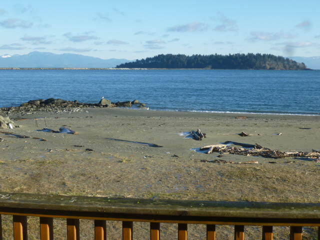
View from Senior Center across NEAH BAY ... CANADA faintly visible in the distant Sea Mist.


6 Miles distant from the Village are MAKAW Beaches fronting the PACIFIC OCEAN ... available to Campers, RVers, and lucky folks who rent upscale modern Beach Front CABINS, fitted out with all amenities at $150.00 per night, kitchen included.

Pictured is a single CABIN, of which some two dozen are available.


CABIN View of AMERICA's most NORTHWEST point of Land, CAPE FLATERY.


MAKAW BEACH SHELTER ...


MAKAW BEACH SHELTER TOTEM POLE.


CAPE FLATERY is visible behind this MAKAW NATION BEACH Outlook.

* * * * * * * * * *


Having driven Highway 112 from NEAH BAY to PORT ANGELES, we parked overnight at WAL-MART;

Breakfast was enjoyed at MAC D's where we created this Blog Update.

In a few minutes, we will drive to HURRICANE Ridge located some 15 miles South of Town (Port Angeles).  One of America's outstanding Outlooks, HURRICANE RIDGE dominates the mountain top NORTH BOUNDRY of the massive "BOWL" that makes up America's YOUNGEST Mountain Range.

"...THE OLYMPIC MOUNTAINS ..."

Complete with 10 living ICE GLACIERS, the OLYMPIC MOUNTAINS offer a magnificent partner filling the WASHINGTON STATE Western Distance to the PACIFIC OCEAN  some 100 miles distant - as the CROW flies.

SUNSETS from SEATTLE - especially while dining in the incomparable SPACE NEEDLE ... as well as views from Oregon to the South and from CANADA to the North, OLYMPIC MOUNTAINS take up Center Stage.

Port Angeles is blessed today with a COLD but crystal clear Sky - so common in these parts, we should be presented with a special HURRICANE RIDGE Spectacular...

...which we shall share on tomorrow's Blog Update.