
 Please meet "B" (on the right) and his friends...inspecting farm equipment along side Highway 33 near CROW'S LANDING, California.
  Twilight in PATTERSON, California...as SPIA and I departing our Neighborhood overnight resting place.
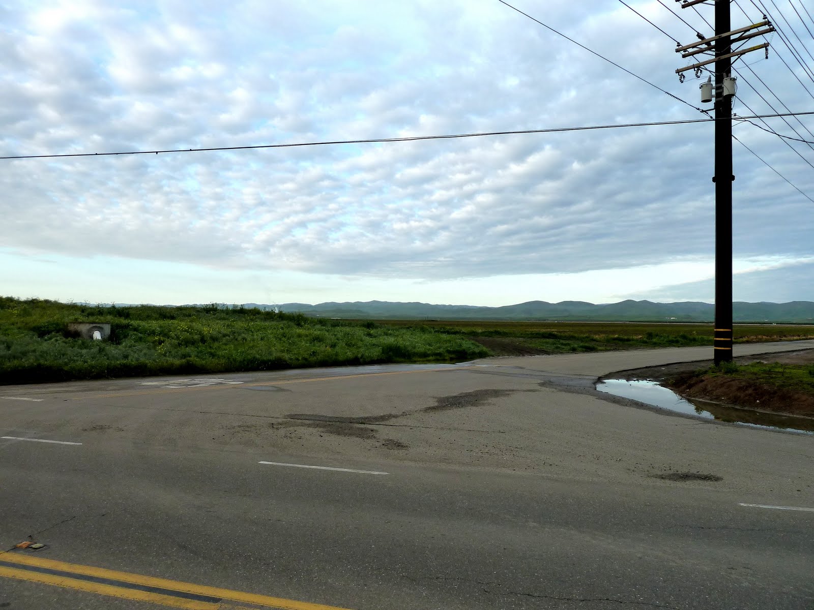 Highway 33 intersection looking South West at the distant Mountains in the General Direction of LOS ANGELES, California
 CROW'S LANDING, California Main Street (Highway 33)...
 CROW'S LANDING, California, where our walk for the day began. SPIA is parked 6 miles North on Highway 33, near PATTERSON, California.
  A new Orchard along Highway 33...CALIFORNIA NORTHERN RAILROAD TRACKS in the foreground.
 RAILROAD EQUIPMENT at work. Those two "Oval" devices with "Claws" touching the ground are used to COMPACT the stones under the Railroad Ties (Wooden Beams) to which the Rails are Bolted. This process stabilizes the rails. This machine appeared to be fully automatic, with a "Driver" watching over everything. Later in the day, I passed this machine again...it was rolling South on the Tracks giving a TOOT TOOT as it passed.
 With the Railroad Tracks in the foreground, the fields of South San Joaquin Valley seem to go on forever. This photograph is looking East towards the city of FRESNO, California.
 A Walnut Orchard "FOR SALE". There are many large properties For Sale along Highway 33.
Highway 33 runs North and South pretty much West of Center down the San Joaquin Valley. Interstate 5 is close by to the West. US 99 (the same Highway as in Vancouver, BC, Canada and all the way to the tip of South America) is to the East about 20 miles away.
All these roads come together at the Southern end of the San Joaquin Valley at near BAKERSFIELD, California ... where the "GRAPE VINE" and "TEHACHAPI" roadways climb the steep 4,000 foot mountains surrounding LOS ANGELES, California.
HEY LOOK !!! The Sun is shining. This is the first day in Weeks that the Sun had been out all day and N O R A I N ....
 This part of the San Joaquin Valley has Water Canals going in every-which direction. I am told by locals that water is VERY expensive and has, together with the Recession, resulted in many large farms to be FORECLOSED; i.e., the large number of "FOR SALE" signs along Hwy 33.
Appears this Canal Sign may have been altered by a previous land-owner recently foreclosed.
 Mail Boxes along Highway 33.
 Two Horses in the front yard of an up-scale modern Ranch House...nice looking animals.
 All Morning I could hear two (2) distinct motors of Crop Dusters...these aircraft are specially equipped to SPRAY Insecticides on Farmer's Fields.
 They rarely get more than 200 feet above the ground and are more fun than watching an Air Show.
This is a DEADLY business. If one looks closely, many Crop Dusters remains are found around local airstrips...usually a narrow path through some one's pasture where the aircraft land, reload with insecticides from large hoses, take off...only to return 15 minutes later to load up and take off again.
Later in the day, I walked upon such an "Airport" near NEWMAN, California. As I walked by, the above Crop Duster landed and took off again at least 10 times. For a while, SPIA was parked near the above horses...the Crop Duster swooped down over SPIA about 100 feet high to land.
 The same aircraft on his "Airport" strip...the runway was all of 50 feet wide.
 Crop Duster making a turn at the end of his Runway, getting ready to take off.
 GUSTINE, California is an old-time town along Highway 33.
 GUSTINE is the prior home of "Larry", who gave me a ride earlier in the day. Larry picked me up a SECOND time and gave a personal Tour of his old stomping grounds.
 The following many photographs are of homes and streets of NEWMAN and GUSTINE, California.
 California Home.
 Please say Hello to Larry and his wee 15-year-old pooch (after all the discussion, I still cannot recall his name - must get me a small voice recorder to remember the names of the increasing number of folks...and doggies...I meet each day).
Larry now lives on Vancouver Island, British Columbia, Canada with his wife and ...lets call him NEEDLES because of the sharp teeth that nearly punctured my left hand...wee pooch. They also have a Mobile Home in GUSTINE, California.
Larry said he picked up the Mobile Home for $5,000.00 and spend the Winter there. For many years Larry and his family lived in (I believe he said) NEWMAN, California.
Sorry Larry...guess the Sun is getting to me...really do need that recorder.
 Little Red School House in GUSTINE, California
 California Home.
 California Home.
 Baseball Diamond.
 California Home.
 California Home...Larry says many of these homes are Repossesed by the Bank...and are rented out to non-owners.
 Wide Avenues in NEWMAN and GUSTINE, California
 California Home...a Painters Dream House ??
 Aaahhh, back to the Farm...Sheep pastured in front of "The Back Road"
Walking South of GUSTINE, there are three ways to reach LOS BANOS, California. After consulting with three separate "Locals", everyone agreed that Highway 33 was NOT the best for walking...and we ended up on "The Back Road"...a series of "Section-Line" roadways that weaved their way down the Valley to LOS BANOS.
 Two Trees...on The Back Road
 Distances across the San Joaquin Valley are just as vast on The Back Road as on Hwy 33.
 "Section-Line" roads are always straight as an arrow and go on for over 5 miles before making a 90-Degree turn either left or right to follow the next "Section-Line".
All of Rural America is made up of Section-Lines (I am NOT an expert on distances of a "Section", but I followed them all the way across Colorado last Summer and again here in the San Joaquin Valley in California. Someone want to Google "Section Line" details?
 Ah Haa...our first encounter with "Siphon" irrigation in California. Last Summer we saw hundreds of such fields in Oregon and Idaho.
The "Horzintal" Water Canal is about 4 feet wide and two feet deep. The "Berm" (side of the Canal has "Hoses" leading from the Horizontal Canal into each of the "furrows" (ditches) of the field where the Crops are grown.
The Hose is filled with water, inserted into the Canal and led into each ditch. The "ditch" end of the water filled hose is LOWER (to the Center of the Earth) than the Canal-end, causing water to flow up and over the Berm into the ditch of the field where the crop will grow...
A Layman's description of how a "siphon" works.
Thieves use the same technique to STEAL gasoline from the tank of your CAR...I remember at about 10-years-old, I did such a trick with Kerosene (Stove Oil) and when SUCKING the Keroseen up into the Pipe, got a mouthfull of the stuff...some of which I swallowed...took months to get rid of the awful taste every time I burped it up...should have Killed ME.
 Angling on The Back Road. This lady's companion (no Pic) said there are Blue Gill Crappies (Spiny Ray) and Strippers (a large Bass) in this stream...with the recent rains, the water is very muddy and fishing is not so good.
In clear-water-days, He says they catch their 12-fish limit of "Blue Gills" in a half hour. Takes a bit longer to snag their limit of two (2) Bass.
This water system is part of the San Joaquin Valley Canals which one can find just about everywhere...takes lots of water to support one of America's major farming regions.
 Click click...little heads bobbing behind the fence of this "ramshakle" home across The Back Road of the following photographs.
 A Dairy Herd...those beautiful milk cows are lying in 6" deep MUD and POOP. Seems there should be a better way to care for them...as afterall, they are the source for: See Below Pic...
 CHEESE FACTORY on The Back Road, California
 Back Road Ranch House - next door to the Cheese Factory and bordering the Fisher-lady.
 Now...this is MUCH better...PAPPA, MOMMA, AND BABY lounging in a paradise of pasture...only a half-mile from the Cheese Factory.
 BIG DADDY ...
Today was my first day walking under the Southern Sun. Got out the Sun Hat and Windbreaker, but NO Rain Gear. Had a major problem with my Panasonic Camera.
...Could not see the rear screen to view the image before taking a photograph...now, what could be wrong this - nearly new - camera. Accidently took off my eye-glasses to take one photograph and PRESTO, there was my image. Seems I forgot I ordered Sun Blocking Glass in my new eye-glasses...turned out to be too dark to see the view-screen image in the bright sunlight.
Really kinda dumb...but then Old Men have such problems, HUH?
DAILY REPORT: Walked 26 miles today...thanks to receiving another 4 rides (thanks all)
SEE YOUR IMPACT.ORG: Credit 26 miles @ $0.02 per mile = $0.52 for the day.
SPIA is parked along The Back Road for the night. I was simply too worn out to complete this Blog update last evening...slept until 2:00 am. It is now 4:45 am and am in need of a couple more hours sleep before bouncing on down The Back Road come 7:00 am daylight.
Will keep making 90-degree lefts and rights until reaching LOS BANOS, California...
Then we shall see.
2 comments:
Section lines in the United States are one mile (1.6 km) apart. When surveyors originally mapped an area, for instance a township, it was their custom to divide the new township into 36 1-square-mile sections. Property ownership often followed this layout. A section is a 1 by 1-mile (1.6 km) area. A half section is a 1/2-mile by 1-mile (1.6 km) area. It is proper to continue this division down to a 1/4 by 1/4 section which is 1/16 of a section, or 40 acres (160,000 m2). The next smaller division is 10 acres (40,000 m2), and then 2.5 acres (10,000 m2). Besides property ownership, roads often followed the section lines, and one can often still see them in modern maps, even in urban areas. In rural areas, these roads are called section roads, and often exist primarily so that farmers can access their land.
Thanks, Bob...More than I hoped for. Good research.
Post a Comment