
 Took a couple pictures of inside SPIA today. Living space is open to the driver compartment, which is usually closed with a privacy curtain. I modified this by putting Sun-reflecting panels on all cab windows, resulting in privacy and gaining open space .
Another pic follows later on.
 US 17 has lots of new construction - making a four-lane highway from the present narrow 2-lane roadway. Note the plastic barrier. All over America, roadway - and other construction too, have these plastic barriers between the work area and surrounding open spaces. It is intended to keep construction waste from flowing out of the construction area.
In most areas, it does seem to work.
 We are currently walking through an area called the "lower land", referring to the marsh areas bordering the Atlantic Ocean, only a mile or two to the East of US 17 pictured above.
There are three rivers draining this basin. The above river is the ASHEPOO River, named after a local Indian Tribe. History will tell that the local Indian tribes joined Spanish forces to try to keep the English and French from settling along the South East Atlantic Shore.
 The rectangular construction jutting out into the ASHEPOO River is a "COFFERDAM".
A Cofferdam is a construction in waterways. Usually steel plates linked together to form a watertight enclosure, the water is pumped out, allowing work crews to enter the Cofferdam to build the concrete / steel bridge supports - also often known as Pylons.
After completing the Bridge Pylons, the Cofferdam is flooded and removed.
 This is the second river I walked across today. It is called EDISTO River, also named for a local Indian tribe.
 Upon reaching the construction area, I moved off the narrow US 17 and walked the sandy unpaved roadbed. It is curious to me: ALL of the South East of the United States - clear into Texas - is mostly SAND.
Looking around roadway construction areas, I see NO evidence of using rock or gravel to give support to the new roadways. I have commented often on the poor quality of road surfaces in the South. I attribute this to the lack of proper road-bed materials to stabilize the sand...add a bit of excess water and SWOOSH...the roadbed is damaged along with the overlying asphalt or concrete surface.
Being no engineer, not my problem...but it does make one wonder !!
 Please say HELLO to Jackson, too busy to chat.
Jackson seems to be an outside contractor for DOT South Carolina (Department of Transportation). He is walking to a set of instruments buried in the sandy soil...the entire roadway is built through a marsh... I believe he is monitoring water content in the sand.
 Edisto River flowing through the marsh to join the sea near CHARLESTON, SOUTH CAROLINA, which is about 25 miles North of this spot.
 Walking 2 - 3 miles through this wet sandy soil, my shoes became thoroughly filthy...
 Another look at the "environmental" plastic barrier...in this pic, there are two (2) rows of plastic to protect the marsh from construction run-off.
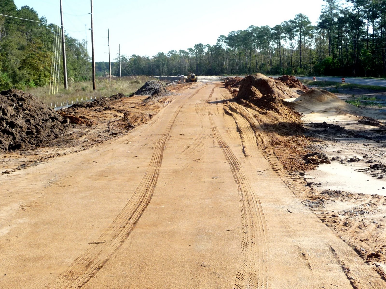 This is where I switched back to the ever-dangerous US 17...that new roadbed is "muck".
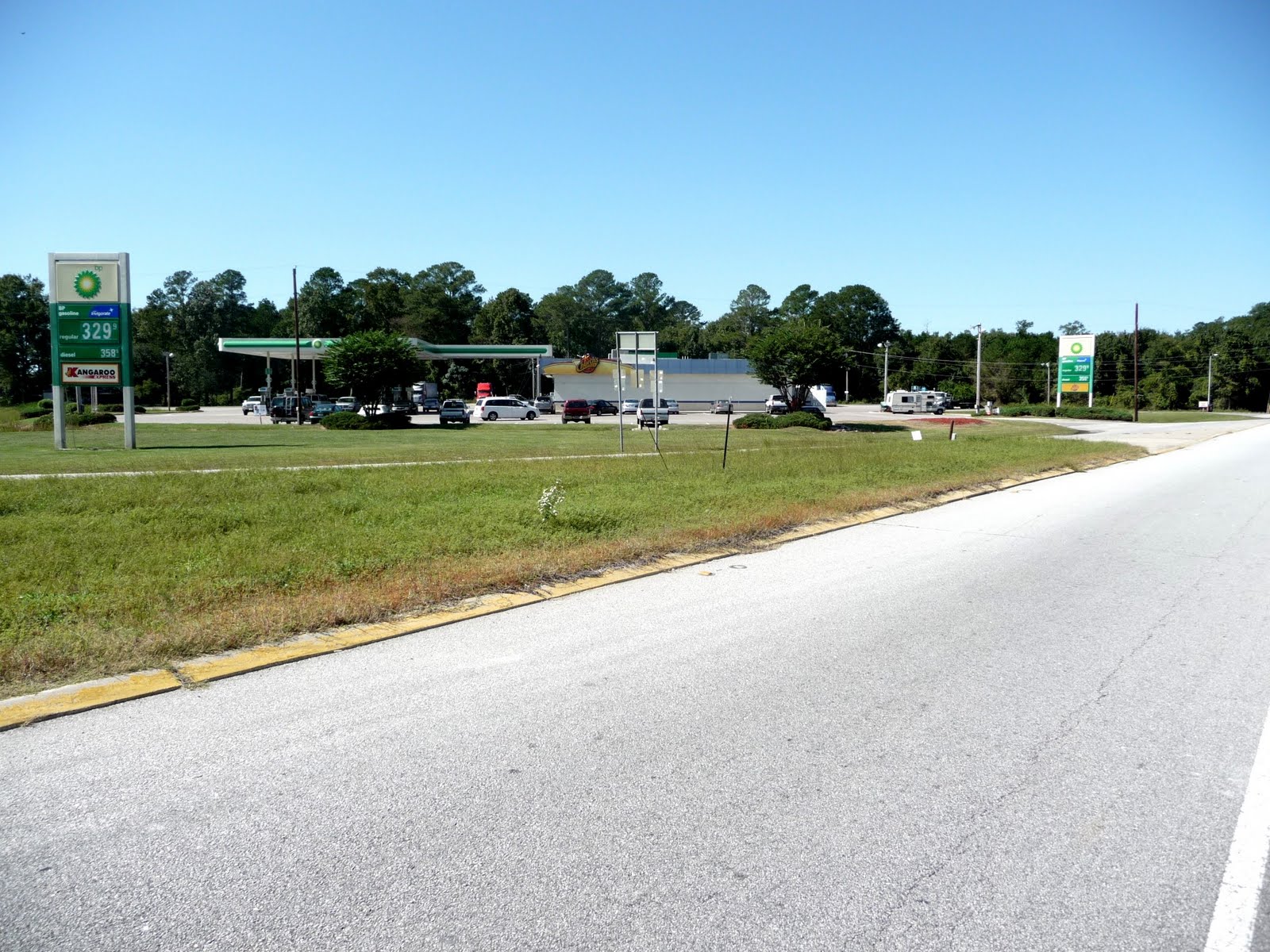 This photograph is out of place...it should have started off today's pics. This is one of three gas stations which comprise the totality of the village of JACKSONBORO, SOUTH CAROLINA.
Looking closely, one can see SPIA in the center-right, parked while I took my second walk of the day.
 A bit of History.
 JACKSONBORO town notices are posted in this Gazebo.
 A good look at the ASHEPOO River, looking West.
 EDISTO River Bridge...at least the bridge has a walking / parking lane.
 Not easily seen even while walking along US 17, is the continuous expanse of water - on both sides of the roadway.
 About 20 miles West of CHARLESTON, SOUTH CAROLINA.
 A section of completed 4lane US 17 Highway...still no walking / parking lane.
This roadway is extraordinarily dangerous. Traffic is always heavy, moving at 60 mph. Many vehicles intentionally "brushed" me back from the White Line into the grass...not my favorite place to walk as I constantly trip over something and snakes to abound around here.
 A rather pretty moment Mother Nature has provided in her watery jungle.
 The ASHEPOO River once again as I returned to SPIA.
 Just passing me is a "trailer-less" 18-wheeler "Tractor".
This phenomenon is known in the trucking industry as "driving BOBTAIL", i.e., without a trailer. There were many such Bobtail Tractors heading toward CHARLESTON today. As CHARLESTON is major Sea Port for Container Ships from around the World, I expect the Bobtail Tractor Drivers were on their way to pick up a trailer with Container for transport inland. Just a "guess" from a youngster who grew up in and around 18-wheelers and later having more than a little bit to do with the Container Handling Industry...see prior blogs.
 A front-yard decor. When I was a kid back in the '30s and '40s, all gas stations dispensed gasoline from a gas pump just like the one above. The top glass tank was the reservoir leading to the hose and nozzle.
 A "long shot" of inside SPIA with the Cab Curtain removed. Forward top is my sleeping area. When not sleeping, it is used for storage...heavy items are moved forward to get weight off the back of SPIA where SAM sits. Forward Left is the double sink, followed (nearer) by the stove / oven, followed by a King Size Pull-out bed which fills the walking space - except for about 4 inches to shuffle through to the toilet and shower behind the camera.
On the right behind the over-cab bunk is a rather large refrigerator / freezer; next is the step-down and door to exit, followed by the "Dinette". The Ice Chest is full of clean/folded clothes for quick use in any weather.
All in all, quite comfy for one person...especially now, since all overhead skylights have been sealed (NO MORE LEAKS). During the hot days, ALL windows, including skylights, have the reflective window coverings to help keep SPIA cool inside...thought of that AFTER crossing all the Deserts of the West.
Tonight, we are parked 15 miles South of CHARLESTON, SOUTH CAROLINA at a "PUBLIX" Supermarket, which is hidden behind a screen of trees from US 17. In the morning, I must walk BACK South for 7 miles to make up what we drove instead of walking - as it was getting late.
Then, I must decide if I wish to walk into CHARLESTON. I am told by everyone that US 17 gets seriously congested ... even on Saturday ... and has NO place for pedestrians. I will sleep on it and come up with an option in the morning.
No comments:
Post a Comment