
 A new option for consideration...a pic of my travel map from time to time.
Referring to the orange penned in line, I started this morning's walk on Hwy 24 where Road 709 intersects (where all the squiggles of Hwy 24 are...to the right). I finished today's walk at left of Highway 122...about where the "24" in the circle is shown.
It is about 20 miles to Roanoke. Will not enter Roanoke proper, but skirt around to the right, intersecting Highway 220 (the yellow roadway heading north), which we will follow until it comes to I-64 (Interstate).
The famous Blue Ridge Mountains start at Roanoke and continue north/east to and beyond Washington, D.C.
 Stepped out of SPIA well before Sunrise...at 7:15 am. Cool with clear skies.
To the far left is the contrail of a jet... cruising +/- 35,000 feet.
 Dark enough to avoid stepping on alphalt-basking snakes, but good to capture a silhouette skulking in twilight.
 Our route, walking East on Highway 24, took us into several deep ravines where the Sun don't shine.
Once in a while, a clearing atop a knoll gives another pic opportunity.
 Try as I might, I have not captured the steepness of roadways (h.e.l.p.).
The next few photographs are today's feeble attempt.


 Home in the forest.
 Bridge over...
 ...the above river...still in twilight, even tho the Sun has been up nearly two hours...is still dark in the twisting diving - climbing roadway we walked for 8 miles.
 Returning to SPIA - in the distance parked next to the church -, took another 8-mile stroll; this time, to the West...looking back to take this photograph.
Click click to enlarge.
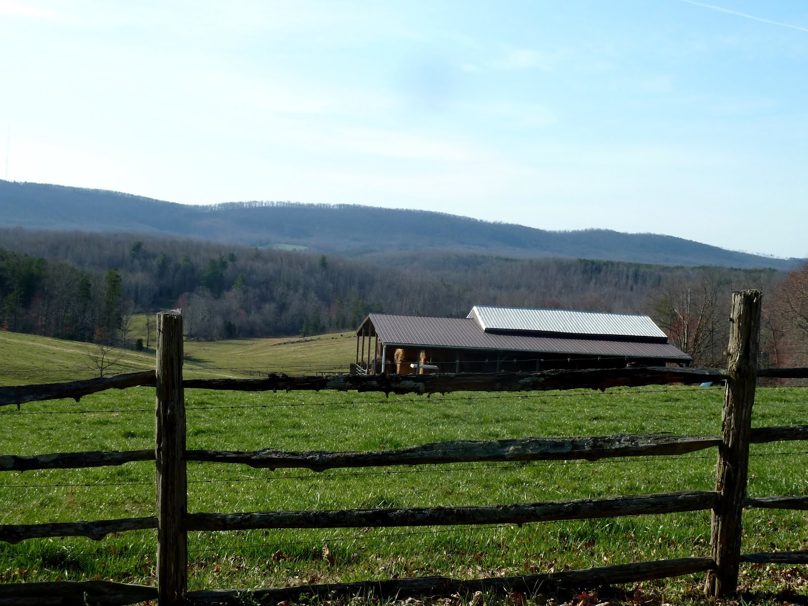 Highway 24 climbed to the West all day.
 About 10:00 am, came out on top of a ridge...lo and behold...the majestic Blue Ridge Mountains have been just opposite (to the north) Highway 24. Could not see them before because of the tortuous terrain.
 Another view of the Blue Ridge Mountains...this mountain range continues to the left, ending on the outskirts of Roanoke. The famous Appalachian Trail travels along the top of those distant mountains...as does the equally famous Blue Ridge Parkway - much of which I have driven in years past.
 ...and yet, another viewpoint to the Blue Ridge Mountains.
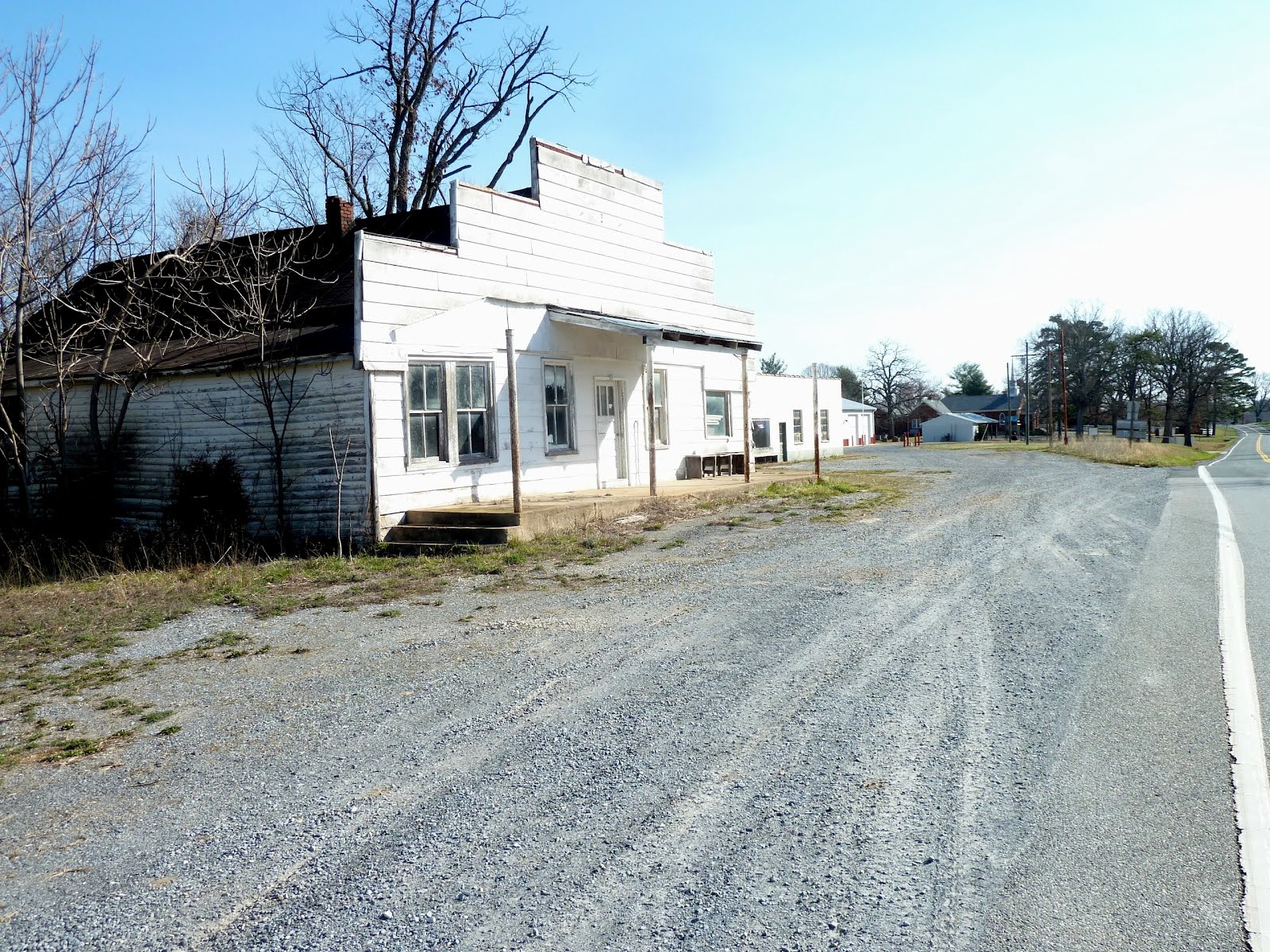 A number of towns marked on the map no longer exist. Walking past, there is not even a sign indicating what the place used to be called.
I became disoriented because of the no-name occurrences...together with the large number of side roads...all of which have a number, but nearly NONE of which show on the map.
 This sign is located in the above Ghost Town; the following pic sits next to this sign...
 A bit confusing...
 Painted mail box.
 SPIA's home for tonight...that small building is the second floor above the convenience store. Highway 24 passes in front.
All together, we walked three sets of 8 miles today: = 24 miles.
 The panorama view SPIA has for tonight...looking back to the East.
The Blue Ridge Mountains are to our left, but hidden behind the trees.
Today's walk was challenging. My legs are not ready for intense ups and downs. Ankles are quite sore from the hills and jumping out of the way of traffic...I always walk the white line...the paint covers the sharp stones in the macadam (asphalt), which cuts up the bottoms of my shoes. Walking on the paint gives 2 to 3 times shoe leather life.
Something I may have not mentioned: When traveling - anywhere, including the cruise -, I always keep my watch on Bellingham (Pacific Daylight Time). Makes my brain do some calculations to know the local time...was somewhat complicated out in the middle of the Pacific Ocean...
So, as I walk each day, my thought processes must constantly calculate local time.
Might be kinda dumb to some, but I truly believe in the tried and true adage:
Use It Or Lose It.
...which as my guideline- perhaps in error - applies to ALL things.
1 comment:
Bruce,
You can't show Elevation on a two dimensional Scene without some kind of reference. Taking photos from the road you will always see a plane Triangle(of sorts)The Sides of a triangle, Never the third dimension of Depth(elevation) . Which is what you would need to show height. You CAN simulate it by moving off the side of the road/Walk/Hiway and taking a SIDE shot. Even better if you use some kind of LEVEL in the shot as a Reference to the angle of the road.. The farther you get back off to the side, the better.
Try this for an Example: Shoot a stairway from the front, then from the side. You will see Elevation in the side shot. It's Pysics and perception. Light will always travel in a (relatively) straight line, so The "Look" of a roadway is a bunch or Straight Lines in front of you,, the Ancient Pyramids look like triangles until you get a little off to the side to show depth. !!
ralph ahseln
Post a Comment