Monday, December 28, 2015
POST 1507; LONG BEACH, WASHINGTON; 12-28-2015
Leaving TILLAMOOK, Oregon this morning, we could see impaired through the dense FOG (clouds lying on the ground)..Early images are not so good taken in dense fog ... but we selected a couple which might suffice.
It cleared up a bit, but returned as we visited the PACIFIC OCEAN Camp of LEWIS and CLARK EXPEDITION, FORT CLATSOP, Oregon. ... located at ASTORIA on the COLUMBIA RIVER Estuary as it empties into the PACIFIC OCEAN.
TILLAMOOK CHEESE FACTORY.
Until crossing the COLUMBIA RIVER BRIDGE at ASTORIA, Oregon, all following photographs are in the STATE of Oregon.
A
More about Earthquakes when we reach the STATE of WASHINGTON.
EARTHQUAKES and TSUNAMIs are serious matters in Washington and Oregon. Historic evidence suggests ancient Earth Tremors resulting from the off-shore FAULT LINE may have exceeded 10 on the RICHTER SCALE in this region. Such an event today would be unimaginable today.
Depicted above are Earths Plates in this region, which are moving North and West. The United States LAND Plate is overtaking the Oceanic Plate, riding UP and OVER the Oceanic Plates. This movement sometimes causes the Plates to "CATCH" (SNAG) on each other. When the stuck together plates finally SNAP FREE, an EARTHQUAKE results. Since this region is UNDER THE FLOOR OF THE PACIFIC OCEAN, a TSUNAMI is most certain to result, flowing far inland and high up the sides of COASTAL MOUNTAINS and HILLS.
SOIL: To repeat information given (vebally and in many photographs) on this Blog during previous walks of the PACIFIC OCEAN U.S.A. from the Straits of JUAN de FUCA, Washington State to SAN FRANCISCO, California.:
Much of the SOIL along the PACIFIC OCEAN is "CLAY" (CLAY= = Mud - like substance which is e effected by moisture -Water Content - and "RESONANCE" ) ("RESONANCE" = VIBRATION ... as is produced by shaking of the Earth SOIL, as in an EARTHQUAKE. The harder and longer (duration) the clay shakes, it tends to "LIQUIFY" ("LIQUIFY" = TURNS INTO A LIQUID).
LIQUIFACTION during severe EARTHQUAKES is of potential major concern and consequence
Some Seaside Homes have great views.
A
LEWIS AND CLARK images (FORT CLATSOP) follow below.
Re-Construction of the 1803 FORT CLATSOP, occupied for Summer MONTHS before the LEWIS AND CLARK PARTY returned to ST. LOUIS, MISSOURI.
SACAJAWEAs Child was nick-named "POMP" BAPTIST. Her Room - with her Husband - is to the far right.
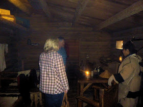
Three Rooms housing the 31 Soldiers who made up the LEWIS AND CLARK Work Party.
SECURED store room at far right, CAPTAINS QUARTERS AT center, and SACAJAWEA room at far right.
Pinpoint of light at center-image is the so called LEWIS AND CLARK RIVER, a short tributary of the COLUMBIA RIVER.
FOREGROUND is open Meeting space.
BUNK BEDS.
FIREPLACE between rows of Soldiers BUNK BEDS.
CAPTAIN QUARTERS.
Volunteers interviewing prospect more volunteers.
ASTORIA BRIDGE over the COLUMBIA RIVER. Remaining images of this blog update are in the STATE OF WASHINGTON.
Cute MOVIE filmed in ASTORIA is "Short Circuit" (Personal Opinion).
CAPE DISAPPOINTMENT located just outside the COLUMBIA RIVER entrance from the PACIFIC OCEAN.
A
Following images are of the villages of SEASIDE and LONG BEACH, Washington.
aaaaaaa
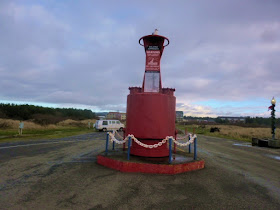
Above image is of a BUOY. All Navigable Waters in the USA - and most of the World - have been "SOUNDED" ( Sounded = TO MEASURE WATER DEPTH). This information is included on MARINE CHARTS ( CHARTS = MAPS OF THE WATER).
On the WATER itself, physical BUOYs are anchored in place, giving Mariners visual information of "RECOMMENDED" water CHANNELS ... similar to the WHITE and YELLOW lines painted on roadways ... to keep traffic where it can move safely ("SAFELY = To avoid hitting another vehicle or RUNNING OFF THE ROAD).
BUOY "SHAPE", "COLOR" and "LOCATION" have specific meaning to Water ( Marine) Navigators.
MARITIME NAVIGATION INTERNATIONAL LAWS are in force World Wide ... just as Laws for Cars, Trucks, Trains, and Aircraft.
* * * * * * * * * *
Tomorrow we continue North on US Highway 101.


No comments:
Post a Comment