
 OCEAN KAYAKS - LIME KILN PARK - SEARCHING FOR THE ORCA - SAN JUAN ISLAND
 LIME KILN PARK - ORCA WHALE FEEDING GROUND - SAN JUAN ISLAND
 4TH OF JULY BEACH - AMERICAN CAMP - SAN JUAN ISLAND
 LT. ROBERTS - "ROBERTS RULES OF ORDER" AUTHOR - BUILDING AMERICAN CAMP DEFENCES
 AMERICAN CAMP - OFFICER QUARTERS - SAN JUAN ISLAND
 AMERICAN CAMP - LITHOGRAPH - SOUTH SAN JUAN ISLAND
 WALKING PATH: TO BRITISH CAMP - PARKING AREA
BRITISH CAMP, GARRISON BAY, SAN JUAN ISLAND ROCHE HARBOR - SAN JUAN ISLAND

 ROCHE HARBOR - SAN JUAN ISLAND
ROCHE HARBOR, SAN JUAN ISLAND ROCHE HARBOR - SAN JUAN ISLAND
 TOWN OF FRIDAY HARBOR, SAN JUAN ISLAND
 LES & LYNN AT HOME - FRIDAY HARBOR
 NATIONAL GEOGRAPHIC RESEARCH SHIP - FRIDAY HARBOR

 ROCHE HARBOR - SAN JUAN ISLAND
 TOWN OF FRIDAY HARBOR, SAN JUAN ISLAND
 LES & LYNN AT HOME - FRIDAY HARBOR
 NATIONAL GEOGRAPHIC RESEARCH SHIP - FRIDAY HARBOR
FRIDAY HARBOR WELCOMING COMMITTEE - SEAGULL FRIDAY HARBOR FERRY TERMINAL
 FRIDAY HARBOR MARINA
 ENTERING FRIDAY HARBOR- SAN JUAN ISLAND
 WASHINGTON STATE FERRIES - Passing In The Fog
 LEAVING ANACORTES FERRY TERMINAL - Before Sunrise - & Very Foggy
 SUNSET OVER LOPEZ ISLAND (L), SHAW iSLAND (R) & SAN JUAN ISLAND (Distant) from East Sound looking West
 SUNSET OVER SAN JUAN ISLAND - Looking West from Upright Channel
 SAN JUAN CHANNEL - Looking West North-West
 JAMES ISLAND - looking South from Bellingham Channel - Olympic Mountains in Background - Giving "Cone Of Protection" -
 SAN JUAN ISLANDS -Looking East - Mt. Baker in Background 120 miles away
 SAN JUAN ISLAND - (British Camp: Upper Left / Am. Camp: Lower Right)
 FRIDAY HARBOR FERRY TERMINAL
 FRIDAY HARBOR MARINA
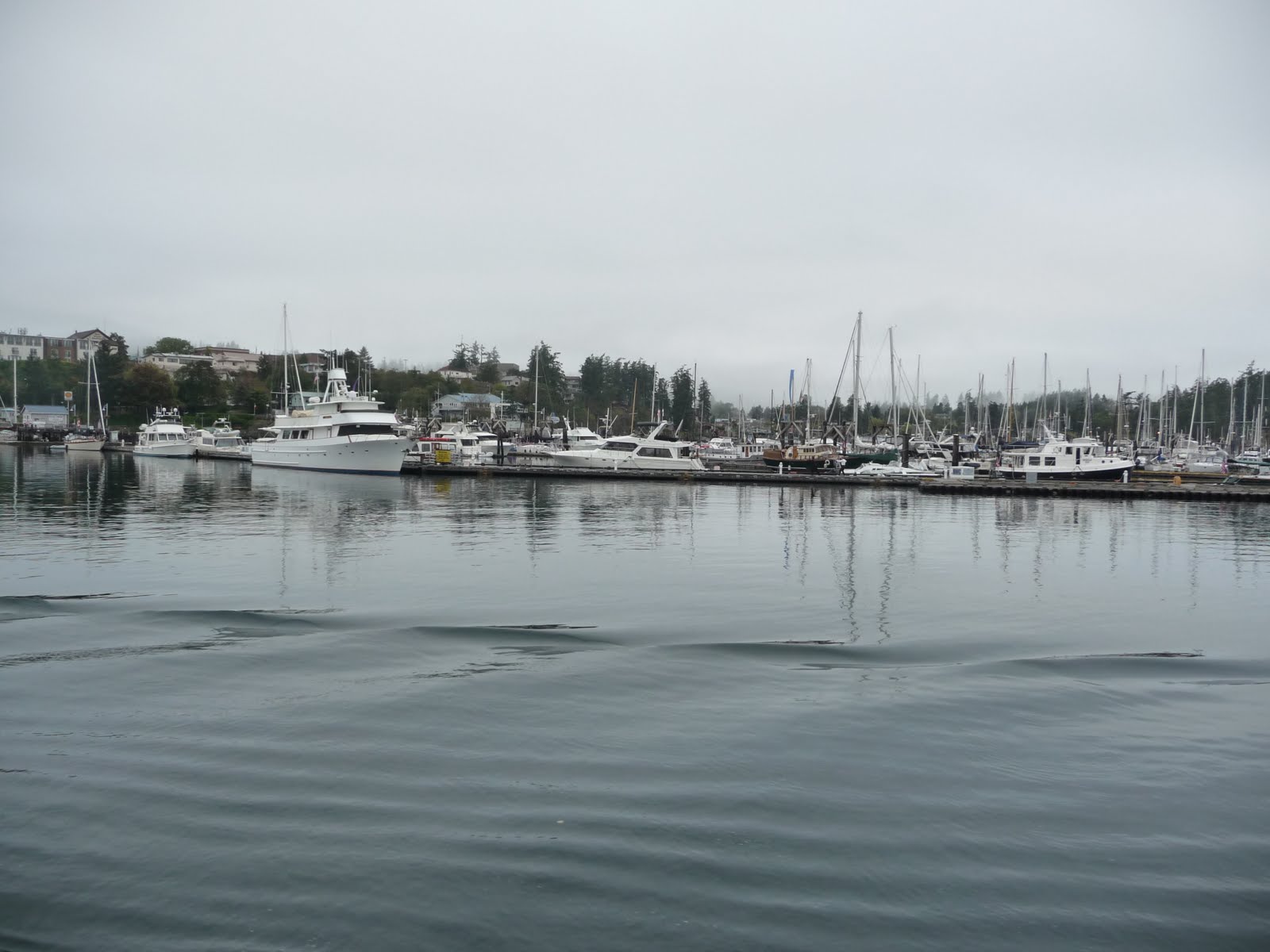 ENTERING FRIDAY HARBOR- SAN JUAN ISLAND
 WASHINGTON STATE FERRIES - Passing In The Fog
 LEAVING ANACORTES FERRY TERMINAL - Before Sunrise - & Very Foggy
 SUNSET OVER LOPEZ ISLAND (L), SHAW iSLAND (R) & SAN JUAN ISLAND (Distant) from East Sound looking West
 SUNSET OVER SAN JUAN ISLAND - Looking West from Upright Channel
 SAN JUAN CHANNEL - Looking West North-West
 JAMES ISLAND - looking South from Bellingham Channel - Olympic Mountains in Background - Giving "Cone Of Protection" -
 SAN JUAN ISLANDS -Looking East - Mt. Baker in Background 120 miles away
 SAN JUAN ISLAND - (British Camp: Upper Left / Am. Camp: Lower Right)
Today, I travelled by car and Washington State Ferry into the San Juan Islands, ending up in Friday Harbor, San Juan Island at the home of dear friends Les and Lynn. I am now back in Bellingham, full of new excitement.
It has been a VERY long day, so, will wait till morning to write about this magnificent Island Group...highly contested by Canada and the USA with a VERY interesting and surprising outcome orchestrated from the other side of the World.
The San Juan Islands number something like 172. I often wonder where that number came from. There are about 15 or so major land masses. Some rise majestically into the often blue sky; some lie quite close to the water - often covered over completely at high tide. Then too, there are plenty of reefs and big rocks hiding just beneath the waters rushing overhead at sometimes 3 - 4 knots of speed.
Where to start ! The islands were formed at the end of the last ice age some 10,000 years ago. Many of the islands have cliffs full of fossils- mostly marine, but sometimes a surprise pokes through the sandstone. The waters are very deep, clear and cold. 300 - 600 feet depths separate many of the islands. The tides create twice-a-day rivers of salt water flowing in from the Straits of Juan DeFuca and the Pacific Ocean some 75 or so miles to the West.
The Pacific Ocean water generally flows into The Salish Sea (the local Indian name for the great inland sea we call Puget Sound) at the bottom. As it spreads into Puget Sound, the San Juan Islands and Canada's inland sea to the North, it wells up from the depths, bringing to the surface, nutrients to feed an unending cycle of sea creatures topped by the magical Orca Whale (Killer Whale) - remember KEIKO - the Whale, NOT my Fiance' from Kokura, Japan).
One thing for certain, one does NOT want to accidentally fall into these waters. Temperature is about 53 F. year round...cold enough to render one hypothermic in five minutes or so, and perhaps survival (without proper protective clothing) about 15 minutes. In addition, the fast moving water passing over reefs and around Islands create turbulent undertows which will take any floating object (like a person) under the water and far away quite quickly. Not a good thing to do...fall into The Salish Sea.
And yet, this must be one of the last unspoiled playgrounds for animals and persons alike.
The Islands can be reached by boat, airplane (land and seaplanes have scheduled flights), or kayak - yes kayak. Many kayakers think nothing of paddling the swift cold Salish Sea waters for many miles just to reach a favorite secluded beach, or bob in the sometimes quite rough waters to catch a glimpse of one of the Orca Pods, or perhaps a colony of seals basking in the sun on a low-slung reef.
Primarily, though, the easiest way to reach the San Juan Islands is via Washington State Ferry. The ferries depart from ANACORTES, Washington on Fidalgo Island (considered to already be in the San Juan Island Group), or from SYDNEY, Vancouver Island, Canada. One pays only for one way...the return to Anacordes is free. Vehicle and Driver from Anacortes to FRIDAY HARBOR and return is about $50.00. Seniors (65 +) can "walk" on for $6.00 or so round trip.
In the Summer months, special walk-on ferries serve the Islands from Bellingham, Seattle, and Victoria, B.C., Canada.
Once a mecca for Salmon, recent years have seen a significant decline in the fishery. Surprisingly, however, the Summer of 2010 is one of record proportions, with some rivers full of Salmon returning from the Open Pacific Ocean after spending 3 - 5 years "growing up" out there. I have not heard a consensus of why so many Salmon are returning to the Salish Sea after so many years of declining numbers. But it seems to be so and is worth investigating.
North American Indians have lived in and around the San Juan Islands for thousands of years.
Many Indian Communities thrive along the Salish Sea today. Special treaties made 150 years ago between the local tribes and the White Man are honored and respected. Lummi Indians, the local Bellingham tribe, have their community adjacent to and in reality, a part of Bellingham. The Lummi are active part in the local economy and play a significant role in local fisheries.
And, Lummi's are only one of the many local tribes.
The San Juan Islands were discovered from the Sea by the Spanish in the 1700's. Most Island names have Spanish origin. Years later, the British explored the Pacific Northwest waters...primarily Captain Vancouver, whose name is prominently affixed to many landmarks - i.e., Vancouver Island, Vancouver, B.C., Vancouver, Washington, etc.
Contemporary with the Spanish and British, the Russians were VERY active along the West Coast of North America. Russia had trading posts from Alaska in the Arctic to the shores of San Francisco Bay, California (see the "Russian River" near San Francisco - I used to swim in the Russian River). Indeed, the United States "purchased" Alaska from Russia.
All this leads me to one specific event...an event which resulted in the San Juan Islands becoming part of the United States of America...not through fighting or acquisition, but rather through one of history's most successful third-party negotiations. It began when an "American" potato farmer on San Juan Island shot and killed a Hudson Bay (English) Pig back in June of 1859.
Hudson Bay Company was firmly entrenched in the Pacific Northwest in the early 1800's. When American settlers came West (see Oregon Trail), many settled in the Island Group tucked away in the cold waters of the Salish Sea. History tells us that an American set up his homestead smack in the middle of Hudson Bay Company activities, and proceeded to plant potatoes. A resident English Pig helped himself to the newly planted potatoes, resulting in ignored complaints from the American, who took matters into his own hands and shot the intruding Pig.
The Governor at Vancouver, B.C., Canada promptly sent a force of English troops to San Juan Island to protect its outnumbered citizens (Actually, Americans - USA folks - outnumbered Brits on Vancouver Island also). President Buchanan countered by sending an American force to San Juan Island to counter the British troops. (Historic note: The first USA Commander on San Juan Island during the "Pig War" was General Pickett, of Civil War Fame. General Pickett's home still stands in Bellingham) .
Another "historic" figure emerged from the early days of "American Camp". One 2nd Lt. Roberts a recent West Point Graduate in Engineering, was assigned to American Camp. His duty included designing and building the defences of the Camp. His "redoubt", included 5 great 32 pound canon off the ship USS MASSACHUSETTES. None of the great guns fired a shot in anger. Historically, however, Lt. Roberts went on and into history as the author of ROBERTS RULES OF ORDER, still used by Parlamantarians for conduct of formal proceedings the world over.
The "Pig War" story is well written in many books - history and otherwise -. Crux of the matter is that the two military groups agreed to disagree and for the next 13 years, lived in some degree of luxury and cooperation. The Americans created "American Camp" on the South End of San Juan Island. The Brits created "British Camp" on Garrison Bay near the North End of San Juan Island. Life was good for both groups...no more dead pigs...but boring. As I have it, the most contact between American and British Camp was to have alternate-week hosting of the Dances held until it all came to an end in 1872.
The Pig War confrontation was put on hold while America conducted its Civil War and Canada was busy with some internal problems elsewhere.
The entire matter was referred to third-party negotiation, with the arbiter being non other than the leader of Germany, Kaiser Wilhelm I. The Kaiser established the international boundary to run through Haro Straits from The Straits of Juan DeFuca to Vancouver, B.C. This boundary put Vancouver Island and adjacent "Gulf Islands" firmly in the hands of the British (Canada), and the San Juan Islands firmly in the hands of the United States.
Monuments on San Juan Island pay tribute to Kaiser's decision. Noteworthy is the comment that the monument is one of the few - if not the only - dedicated to a peaceful settlement and not dedicated to a waring settlement as most other monuments throughout the USA do. (Stop and read the "Historic" monuments found along USA highways...revealing how we came to be the nation we are today).
I refer only to San Juan Island in today's Blog. That is because, I had no time to visit and photograph any of the other many and equally interesting places of the San Juan Islands.
Next weekend, our Yacht Club, Squalicum Yacht Club, of which I was Commodore in 1995, holds it annual "clean up" of Sucia Island. Sucia Island is a gift from the private citizen boaters of the Salish Sea. It was purchased by the Yacht Clubs - all of them - and handed over to the State of Washington as a marine sanctuary / park to be maintained and used for the benefit of all boaters. Our Yacht Club, Squalicum Yacht Club, has a tradition going back to the 1930's, of hosting "clean up" of one or more of the various San Juan Islands.
Next weekend, is Fossil Bay (millions of fossils on the beaches), Sucia Island. I plan to hitch a ride with one of my many boating friends, and do my part in the two-day "clean up". Of course, the work parties will hopefully be the subject of another blog - complete with pics. It is said in some Yachting circles that Squalicum Yacht Club events produce some of the best cuisine to be found in the Islands of the Salish Sea.
If anyone is in the area, please let me know if you would like to join us on Sucia. You will work your tail off, and remember it for the rest of your life. I am certain I can arrange an extra bunk or two aboard one Yacht or another. Bring working shoes, gloves, and rain gear...it is, after all the Pacific Northwest.
No comments:
Post a Comment