Just daybreak as I stepped onto Hwy 60 for today's first walk ..8 miles to MIAMI, ARIZONA.
 Many photographs today have my shadow in them. I am not completely well today and making some basic mistakes. Yesterday, climbing the 7 + % hills, I strained my left foot by stepping on the edge of the macadam, twisting my foot and leg - about where the bridge was. Last night, the tendon attached to the first toe was sore, as was the Shin Bone where it that tendon attaches.
This morning, it is tender, but with careful walking, I managed to get through the day...and the pain is nearly gone...so, so far so good.
Also, I am fighting a sore throat. The room I slept in at Dan & Lisa's had an air conditioner duct directly over the bed...my body is just not used to such cool air and I woke with a sore throat...I'm keeping it under control, but it is making me a bit weak to climb these hills.
 Click click...road sign says it is 4,600 feet elevation. For 7 miles from this sign, Highway 60 descends to 3,500 feet at MIAMI, ARIZONA. When I walk down, must also walk back up to fetch SPIA.
 Am in the Rocky Mountains now. For the next couple weeks I will be facing some rather steep hills - both up and down. Highway 70, South to EL PASO, is not nearly as steep as my alternate choice, Highway 60 which heads North East towards ALBUQUERQUE, NEW MEXICO.
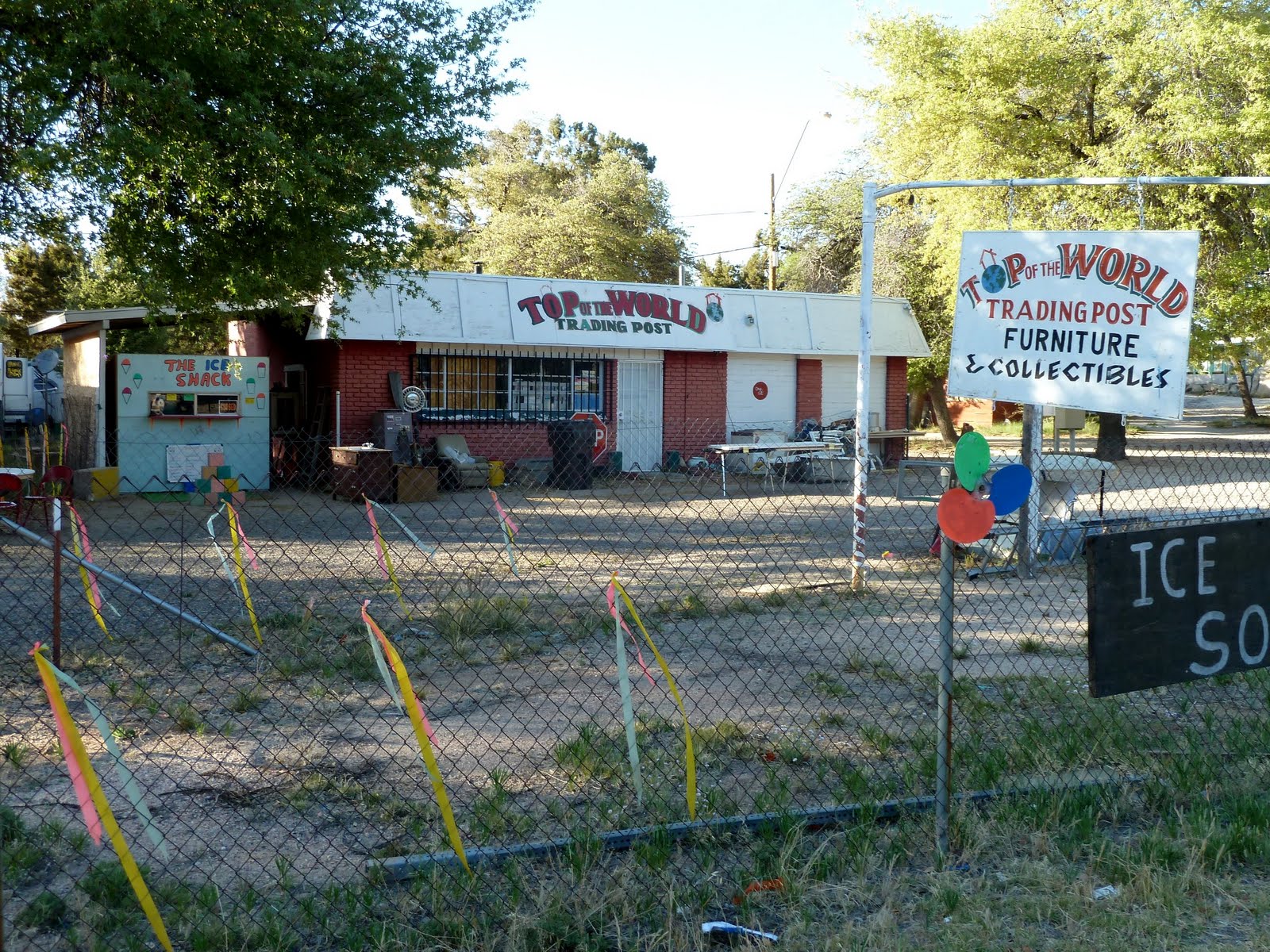
 Highway 60 takes a dive off the 4,600 foot TOP OF THE WORLD, where we stayed last night.
 Highway 60 is cut through solid stone.
 The next few photographs are of various Copper Mines. This area has MANY Copper Mines. Whole mountain tops are cut off.
 Highway 60 takes a dive off the 4,600 foot TOP OF THE WORLD, where we stayed last night.
In the middle of the night, something ran into SPIA with a big THUNK. Then I heard running foot steps and voices of teenagers. Seems someone - in the dark, slammed his head into the front of SPIA's Mom's Attic, where I was sleeping. Sure hope he is ok.
I did not see Charlie by the time I left TOP OF THE WORLD, but left him a note of thanks and apologizing for any head injury.
 Highway 60 is cut through solid stone.
 The next few photographs are of various Copper Mines. This area has MANY Copper Mines. Whole mountain tops are cut off.
 The town of MIAMI was founded back in the mid 1800's because of the Copper in the mountains. Today, an additional four town have joined MIAMI to form a nearly continuous City along the mountain tops at 3,400 foot elevation...all surrounded by Copper Mining operations...going on yet today in a big way.
 I wonder: just how does such a concentration of apparently pure copper deposit get onto the tops of all these mountains.
 At least three separate mines are in this photograph.
 Yes, the stone in this mine looks white...is actually copper...concentration is unbelievable.
 The distant mountain mine is only one of a number - in fact one big continuous mine cutting down a number of mountain tops over the past 100 or so years until today, there is only one mountain at just above city level....awesome.
 This is the town of GLOBE, the larges of the 5 towns which have joined - physically - together along the Copper Mountaintops.
A festival was being set up in the street...held yearly, as I tracked down a Jewelry Store where I had a new battery put into my wristwatch. "Actually, Walmart did it this morning, but screwed it up but good. It ran ok, but none of the buttons worked. The "watch lady" said...I only have training to change batteries...I am dyslexic and don't know anything about watches but how to change the battery. I suggested to the Manager that perhaps Walmart should consider extending their training.
 GLOBE, ARIZONA main street.
 Looking back on GLOBE as I walked South on Highway 70.
 Highway 70, looking South...will be crossing those mountains tomorrow.
This evening, my right Shin Bone is also a bit tender...must be very careful at this time not to injure the muscles...for the moment...caution is the word.
 Walked South on Highway 70 for 5 miles to the Apache Gold Casino...down the left highway above. Have taken a spot - # 38 at the Casino RV Park.
 Apache Casino has a train which carries clients from GLOBE out the 10 miles to the Casino.
 GLOBE, ARIZONA main street.
 Looking back on GLOBE as I walked South on Highway 70.
 Highway 70, looking South...will be crossing those mountains tomorrow.
This evening, my right Shin Bone is also a bit tender...must be very careful at this time not to injure the muscles...for the moment...caution is the word.
 Walked South on Highway 70 for 5 miles to the Apache Gold Casino...down the left highway above. Have taken a spot - # 38 at the Casino RV Park.
Washed up my bed clothes, took a shower, emptied all SPIA waste water tanks and filled up the fresh water. Also topped off the Propane Tank and Gas Tank.
Also stopped at Safeway and purchased items to put into the fridge...is stuffed as full as I can get it.
We have a couple hundred miles of desert to cross starting in the morning...all is ready as I can make it.
Our $$ are nearly depleted, but I am going into the Casino in a few minutes to have me a Steak Dinner. There will not be many places to spend $$ for the next few weeks, so being careful, we should be OK.
 Apache Casino has a train which carries clients from GLOBE out the 10 miles to the Casino.
Tried to get a Toot Toot, but, no soap.
DAILY UPDATE: Walked 18 miles today...some back and forthing in the 5 towns.
DAILY UPDATE: Walked 18 miles today...some back and forthing in the 5 towns.
SEE YOUR IMPACT.ORG: Credit 18 miles @ $0.02 per mile = $0.36 for the day.
In the morning, will walk South on Highway 70 for about 4 hours; then move SPIA and take it as it comes.