Translate

Powered By Blogger

Friday, June 28, 2013

POST 1146; JUNE 28, 2013; DECORAH, IOWA* * * * * * * * * *


* * * * * * * * * *

Because of poor VERIZON signal strength along the Mississippi River Iowa Ridge the past few days, we once again combine two days in one blog update. 

After spending a restful night in Barbara's GUTTENBERG MOTEL, we took breakfast at 6:45 am...setting off North on US 52 early...only to be greeted by one of Iowa's steeper hills to climb up out of the Mississippi River Valley...then, further delayed by road construction equipment cleaning up after the recent heavy rain flooding.

Our original destination of POSTVILLE, IOWA, was summarily cut short upon coming face to face with a most unique lady as SAM and ME entered the small but entrancing village of GARNAVILLO, IOWA.  The next 24 hours stopped my world turning...


US 52...looking back on the riverside town of GUTTENBERG, IOWA.


Water Fountain in one of the many tidal basins of Guttenberg, Iowa.

Heavy local rains produce prodigious amounts of flood water draining into the town of Guttenberg.  The tidal basins collect this runoff, keeping the down mostly dry.


Guttenberg Tidal Basins...looking South.


Please say HELLO to LINDA and GARY...out for an early morning ride.  We all three started the steep climb up US 52 to EAGLE RIDGE, some 2.5 miles distant...with Gary's parting goodbye..."..have a good climb !! ".


Road Construction Crew Flagman.


Heavy equipment cleaning up US 52 hill up Eagle Ridge after the flooding rains of the past few days.


Near the top of the hill...looking back into the Mississippi River Valley.


Our final clear view of the Mississippi River...from here, we follow US 52 as it turns North West...away from the river...and out onto the broad plains stretching all the way to the Rocky Mountains...still some 1,000 miles to the West.


EAGLE RIDGE Water Tower. 


US 52 crests atop Eagle Ridge.


...returning the endless panorama views...


A Chicken Ranch....perhaps one of the top foul-odorous places to walk...passing chicken hauling 18-wheelers carry the smell with them, too.  Wondrous how such a tasty creature can produce such an obnoxious smell.


The far distance holds a small town...to capture my attention for the next 24 hours.


Please say HELLO to SUSAN and BOB...to become our hosts and in the case of Susan, mutual confidant.


Some of Bob's artistic handiwork...a new Fire Department Water Truck...created by Bob from the remains of an ancient retired Army Truck.


Not only is Bob's TOP GUN, probably the County's most lucrative business, Bob is also a volunteer Fireman, EMS Responder, and City Council Member.


Another of Bob's handiwork's.


Bob confided that wife Susan, a highly successful business woman of her own right, can be very persuasive...and did I ever fall into her Aura.

...not that I made ANY effort to wiggle free ...


As SAM and ME walked up to the TOP GUN property...including the 1800s home pictured above...in which I spent a restful night in the bedroom top-left..., Susan RAN out to intercept us.

Seems Susan had seen SAM and ME walking for the past two days and decided we would be her guests if and when we passed by.  We did (pass by)...and she did (become our hostess).

Bob, his nose - and all else - engrossed in his spotless clean auto-body shop, was rebuilding for the third time a nearly new Chevy Sedan.  Susan took the moment(s) to chat with me for hours on end...SAM and ME's walking far away on some other planet.

Without going into details of our near railroad track lives, enough to say I became captivated...to the point that I suggested to Bob he might want to consider me as his employee (so difficult, says he, to find good ones).


After only 15 miles walked, I agreed to spend the rest of yesterday chatting and being "toured" around town by Susan...staying on for dinner...staying on to sleep the night in their historic home...to be driven in the early morning by Susan some miles along US 52 - to make up the miles she had stolen from SAM and ME.

I again passed by the Soldier's Memorial in City Park...which, says Susan, will hold over 500 visitors on July 4 for the most spectacular celebration - and parade - any small town ever put on in the entire good ole US of A...and she should know, having been the exception to the rule that most middle Americans rarely travel more than 50 miles from their birthplace during their entire lifetime.


One last photograph of main street Garnavillo as Susan drove SAM and ME North on US 52. 

Saying good bye is always a difficult moment for me to all the hundreds of new friends we have met in the past three + years walking America.  Saying good bye to Susan was it's own unique moment...I remember little of the next many hours of walking behind SAM...indeed, it is now nearly  2:00 am (midnight) early in the morning of June 29...and I am still not thinking clearly.

Perhaps tomorrow I will be better...June 30 takes me one year closer to 80 !


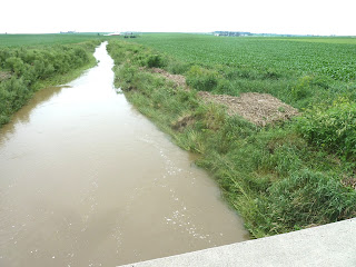
...even so, the streams continue to flow...


...the silver road continues to stretch to the horizon...


...the crops continue to grow on terraced  Iowa farmland...


...and, the evening skies continue to gather storm clouds for the coming rain...


...it is not too clear in my head..., SAM and ME's entry into the city of DECORAH.  I know I missed a turn back on IOWA 51, adding nearly 8 miles to our walk...so much for gaining miles being driven by Susan this morning...

I know a Decorah Police Car pulled up alongside SAM..."...are you OK...?"

I know we checked into the local SUPER 8 Motel ($92.00), wolfed down "all you can eat" Cod Fish in the hotel restaurant pictured above.  I know I have been at this computer since 6:30 pm yesterday (it is now past two o'clock in the morning) evening - now more than seven hours of manipulating hundreds of photographs into a (hopefully) rational storyline, creating and posting blog updates for the last three days.

I will now post this final (and current) update to both GOOGLE and FACEBOOK. 

Then, will take a hot shower.

Then, slip into the feathers and listen to my six - yes six - pillows...

for, "Tomorrow Is Another Day"

- Gone With The Wind -

Early tomorrow morning, SAM and ME will walk and roll ever North and West on US 9...our attempted destination, the town of CRESCO...or perhaps the wee village of CHESTER, some 30 miles distant. 


POST 1145: JUNE 26, 2013: GUTTENBURG, IOWA


* * * * * * * * * *


Today is Friday, June 28, 2013.  There has been no VERIZON signal the past three days to complete our update, but SAM and ME are now in the town of DECORA, IOWA, safely in our room at the local SUPER 8 motel.

The IOWA countryside as we travelled North paralleling the Mississippi River, has been steep climbs out of the river basin to the ridge(s) above...which provide panorama view in all directions out to at least 50 miles.  US Highway 52 is alternately excellent and severely broken along the berm from passing 18-wheeler trucks.  Rain storms have come and gone, getting us wet, but not so soaked as in the past few days. 

SAM and ME have enjoyed a day of rest in the home of PAUL and NANCY sited high on a ridge about 15 miles East of the city of DUBUQUE...and about 10 miles beyond the historic city of GALENA.  Early in the morning, Paul and Nance drove us into DUBUQUE, where we enjoyed an excellent breakfast...then on to US 52, where we unloaded SAM from their SUV...and said our reluctant good byes.  They deposited us on top of the high ridge following the Mississippi River, giving us fantastic view for the first 15 miles or so...then, the hills begin...


Looking back South East into the Mississippi River Valley toward DUBUQUE.


Soon after saying good bye, we passed through the small hillside village of RICKARDSVILLE, IOWA.


Say GOODBYE to PAUL and NANCY...and once again thank you for having SAM and ME as guests in your home...more like family than guests........


One year ago, I walked into the Convenience Store "FOOD MART", astride US 52 running along the steep sided ridge alongside the Mississippi River...

Please say HELLO to MR. WOLF....as I entered the Food Mart, Mr. Wolf, sitting in the same chair as last year, greeted me with..."...well, hello...your back again...where is SPIA?"

SPIA was my small Toyota Motor Home, which I used to solo circumnavigate America last year (SPIA = Seniors Performing Incredible Acts...so named by a teenage follower of more than three years). ..."Sold it...decided to walk the route again...just SAM and ME !"

Mr. Wolf is not unusual...in that many folks on this trip remembered me from last year, as the route is about 90% the same.  ...Have enjoyed meeting these folks again.


FAST FOOD Convenience Store...


I tried to rush past this sewing circle of local ladies...was too slow...receive several "moos" of recognition as they quickly rose from their afternoon rest...and rushed to the fence to greet us.


Been quite a while since we had a visit from the local SHERIFF.  This officer asked for my Drivers License...and took it back to his vehicle to check us out.  Coming back, he handed back my card...apparently satisfied that I checked out OK...asked me to try to keep off the paved part of the road...welcomed me back (to IOWA), and wished us a safe walk.  No doubt, his computer still has data from our previous walks across America...this being our fifth (5th) crossing.


A number of small villages are not even on AAA Road Maps, which I use for our walks.  HOLY CROSS is a single lane leading off US52 climbing a rather steep slope to the tiny village three blocks up.


The cone shaped cloud in the distance is about 5 miles away...moving quickly toward SAM and ME.  This STORM CELL is typical to isolated storms moving across the open prairies of mid America.  They normally move fast...are accompanied by many other Storm Cells.  Caught in their vortex, they often contain winds in excess of 45 miles per hour, lightning and thunder, heavy rain downpour...and often hail and even snow...even in Summer.

Storm Cells such as the one above are in reality, small versions of HURRICANES...and undeveloped TORNADOES...and can be quite dangerous.


As we venture deeper into the mid-continent prairie, the number of drainage waterways is decreasing.


The prosperous down of LUXEMBURG is about half way between DUBUQUE and our destination of GUTTENBURG (which is at water level of the Mississippi River).


LUXUMBURG, IOWA Main Street...of which there are two, forming cross roads at the center.


The "other" main street, as SAM and ME follow US 52 North ... still following the high ridge above the Mississippi River.


US 52 offers up two V E R Y long and steep hills during this part of our walk.  This image is Hill # 1.  It was while fighting to hold SAM ( weighing something over 200 pounds) back as we descended the steep grade, that I discovered a simple way to slow her down (she has brakes, but not for the long steep hills)...simply travel in the side berm...on hills, the roads nearly always contain tall grass or sand for berms...which automatically slow SAM...making my job much easier.

Only took me a bit over three years to figure that out.


This hill rivaled those of West Virginia...much wider and better maintained, but equally steep.  This hill is about 3 miles top to bottom.


At the bottom of the hill, we enter a wide valley.  In all directions, flood water still cover most of the land...most recently planted with corn or soy beans...now ruined.


Please say HELLO to DUANE HAGEN...84 years old...living in the flood zone of the TURKEY RIVER.  I stopped to chat with Duane for over 1/2 hour...helping him move his boat trailer (we did it with brute strength), and chat about the river valley, walking, and his efforts to block the ever present flood waters...not only from the Turkey River, but also from the ridge behind and above his home.


The home of Duane Hagan.


The swirling flood waters of the TURKEY RIVER.


Flooded farmland in the Turkey River Valley.


...and so, SAM and ME climb the steep US 52, out of the Turkey River Valley...returning to the interrupted ridge line...giving back majestic view toward the distant Mississippi River.


...and we quickly arrive at the second of the steep hills...this one taking SAM and ME all the way down to river level as we approach the village of GUTTENBURG...where we will stay the night in the GUTTENBURG MOTEL...($50.00).


As SAM and ME pass over the top of the ridge, there is a "OVERLOOK" of the Mississippi River...offering the above Historic Information.

Please click click to enlarge the image for easier reading...applies also to the next photograph.


The MISSISSIPPI RIVER.


US 52 is much steep than it looks in this image.


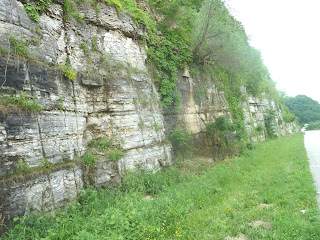
GALENA cliffs...


...and, we arrive in GUTTENBURG, IOWA.


Next door to GUTTENBURG MOTEL is the STDIUM BAR and GRILL, where I enjoyed both evening dinner and 6:30 am breakfast.  During the night, the manager also stored our water bottles and ice packs in his freezer overnight...giving us solid ice water bottles for our walk tomorrow.


Please say HELLO to Barbara...owner and operator of the GUTTENBURG MOTEL...one of the cleanest and best appointed small town motels I have had the pleasure to enjoy overnight.