
 BILOXI, MISSISSIPPI "Isle" Casino, one of three or four new Casinos along the waterfront next to US 90.
 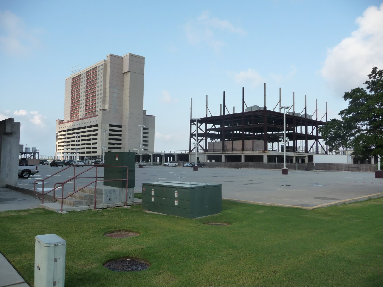 Continuation of the "Isle" Casino, construction has been stopped for quite some time on no less than three full blocks of waterfront space. Already the interrupted construction is rusting and most likely will have to be destroyed.
 Across US 90 from the Isle Casino is the Grand Casino. It appears to be completed. All I can say is these guys have more $$ than good sense. Up the US 90 about a mile, a complete Casino has been wiped out by Hurricane Katrina, as are block after block after block of smaller constructions along US 90.
US 90 stands about 5 feet above the water line of the open Gulf Coast - Gulf of Mexico. There are NO barrier islands; there are NO storm walls; there appears to be NO provision for diverting or stopping high waters such as Hurricanes develop.
This ocean front for 20 continuous miles is simply TOO beautiful for words...said the Honey to the Fly.
 One Exception is Deer Island, a 1/2 mile long low-lying barrier island which sits 1/2 mile off shore directly in front the Isle Casino.
 Walkway from the Beach to BILOXI SCHOONER PIER COMPLEX.
 Three or four new / repaired marinas are in operation along the length of the beach...a beach of pure white sand, almost a fine as talcum powder...a light breeze and it blows across US 90 and inland for a few blocks.
 From Isle Casino, Deer Island stretches East to the center of the large Bayou separating BILOXI from OCEAN SPRINGS, MISSISSIPPI. A new bridge - one of three such magnificent new structures around BILOXI, is 1.7 miles long and a favorite for walkers, runners, and bikers. I walked all three bridges twice.
 A "Casino Hopper" runs around BILOXI offering "free" rides to any / all of the Casinos.
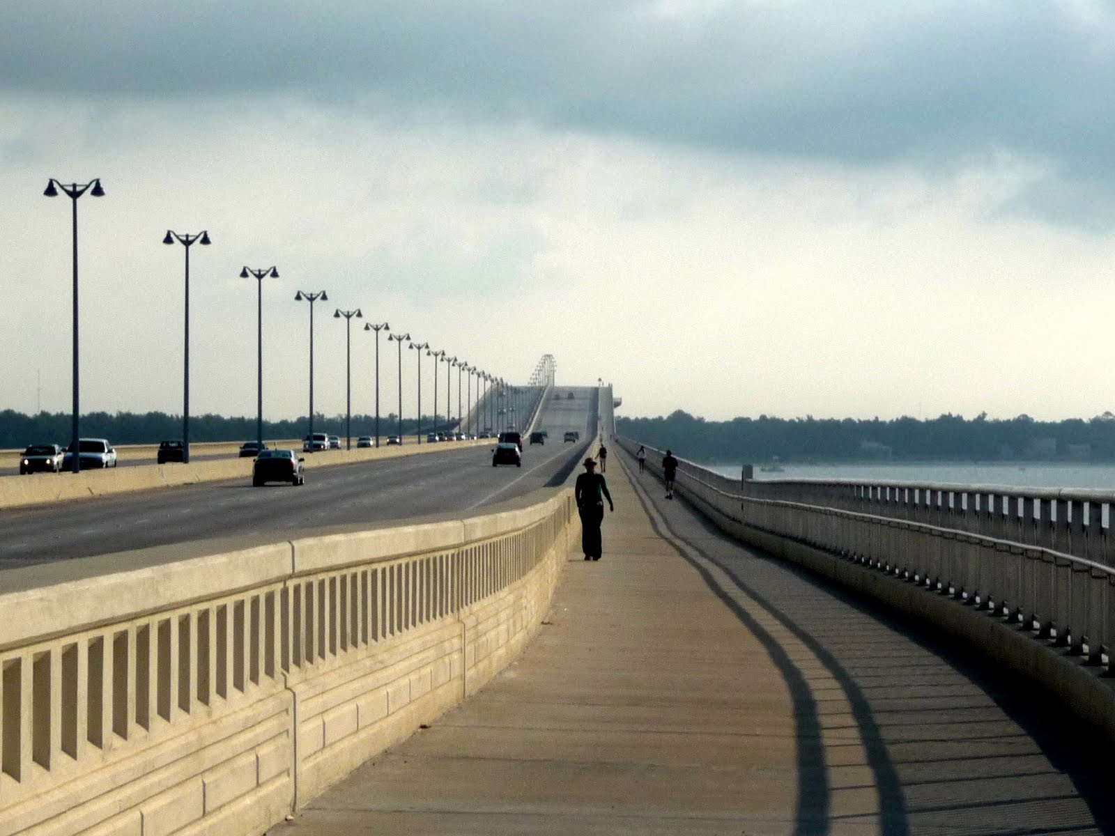 The new bridge showing the walking path, looking East toward OCEAN SPRING, MISSISSIPPI.
 and, another view. There were actually many folks walking / running this bridge...photo is not so representative.
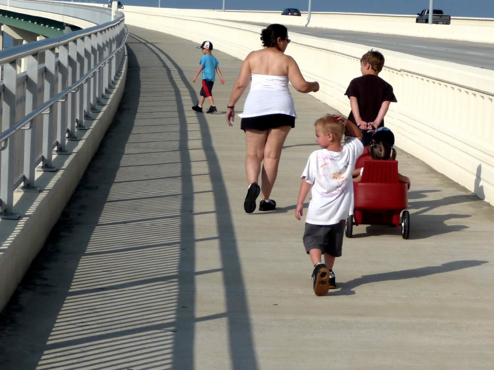 Very young folks also walk the 1.7 mile bridge.
 OCEAN SPRINGS, MISSISSIPPI welcoming sign...an old Railroad Caboose.
 A waterside home near the bridge on the OCEAN SPRING side.
This home has the view of the entire BILOXI skyline as well as the Gulf Coast.
 From OCEAN SPRING, MISSISSIPPI, Yacht Club, looking at the new BILOXI - OCEAN SPRINGS Bridge.
 Local private boat about to pass under the new bridge opposite BILOXI - OCEAN SPRING.
 Ingalls Shipguilding, Inc...photo taken from the new bridge over the Bayou on the West side of the city of BILOXI.
 In years past, I worked with Ingalls Shipbuilding on the APOLLO Moon Rocket Project. I was Contracts Manager on a huge Bridge Crane which Ingalls used to handle the massive Saturn 5 missile first stage, which was fabricated in those white buildings.
The white bridge in the foreground is for the Railroad. That bridge is called a "cantilever" bridge, which lifts the right end of the bridge high into the air allowing tall ships to pass under.
 This is an oil drilling platform with supporting legs. The platform is fabricated with those round legs standing high into the sky. When positioned over the selected work area, the legs are lowered to the sea-floor, lifting the platform out of the water to a height of about 50 feet.
 A "Mobile Gantry Crane", which uses the tires of a B-52 Bomber to move around the dock yards. This crane is driven by a push-button yielding "driver", positioned over a boat - even sailboats with the mast still standing - and moved around the marina / shipyard. My own yachts were normally moved by a mobile Gantry Crane nearly identical to the one pictured.
This type crane was also fabricated by the company I worked for in Seattle, Colby Crane...purchased by Puget Sound Bridge and Dredge...purchased by Lockheed Corporation, which renamed the yard "Lockheed Shipbuilding Corporation".
 A close-up of the Cantilever Railroad Bridge. Large heavy "counterweights" are in the left end (curved from top to bottom), to help lift the opposite end of the bridge into the sky.
 Home along US 90 East of OCEAN SPRINGS, MISSISSIPPI.
 Welcome sign to ALABAMA.
 Google has informed me that all FREE photo uploads is F U L L. Have many more photographs ready for upload for this two days of blog.
Have purchased more space from GOOGLE, but will take up to 24 hours to continue...See you later
Above photo is a "Black Water" stream. I could see the bottom through the water. Water is NOT Black. I determine that the "black" comes from a combination of bottom strata and rotting vegetation which absorbs the sunlight instead of reflecting light back through the water.
Then again, I'm probably wrong !
 More to come...VERIZON is v e r s slow tonight...try during the night...nite nite ! ! !
Nearing walk completion came upon this scene of "Pony Rides". Stopped to chat with the horses, and found Fred sitting back in the shadows. Spent a delightful few hours with Fred and his Grand Daughter, Payton, while we shared my watermelon.
Fred invited SPIA to spend the night. We did, parked along US 90 which runs below his home.
 This little fellow took to me right off...Fred says he wants to go with me..
Please say HELLO to Fred. Fred is a 63 year old Army veteran who calls MOBILE, ALABAMA home...even tho his home is in GRAND BAY, ALABAMA. Fred has a string of Ponies (small horses), with whom he has a business called "Circle "B" Pony Rides and Hayrides.
DAILY REPORT: Two day walking = about 40 miles.
SEE YOUR IMPACT.ORG: Credit 40 miles @ $0.02 = $.0.80 for the 2 days.
Fred has offered to hitch up his 2-wheel cart to one of his ponies, and take me for a ride around the countryside in the morning. Will walk East on US 90 early in the AM, return to SPIA, and see if Fred is up to "carting".
MOBILE, ALABAMA is about 25 miles East on US 90. The Florida border is about 80 miles from Fred's place. Should reach Florida in 4 days or so.
No comments:
Post a Comment