
 The COUNTRY TAVERN, SPIA's home for the night - see SPIA beyond the gate.
When I stopped in last evening to ask Crystal for a spot for SPIA - and a cold beer -, it was so dark inside, I could see nothing ! Until I took the flash photo, I didn't know what Crystal looked like. Thanks again for SPIA's spot.
Left SPIA parked and walked North on US 81 - Business, which connected with US 81 about a mile out...then walked another 4 miles and returned.
 US 81 - Bypass through RUSH SPRINGS, OKLAHOMA.
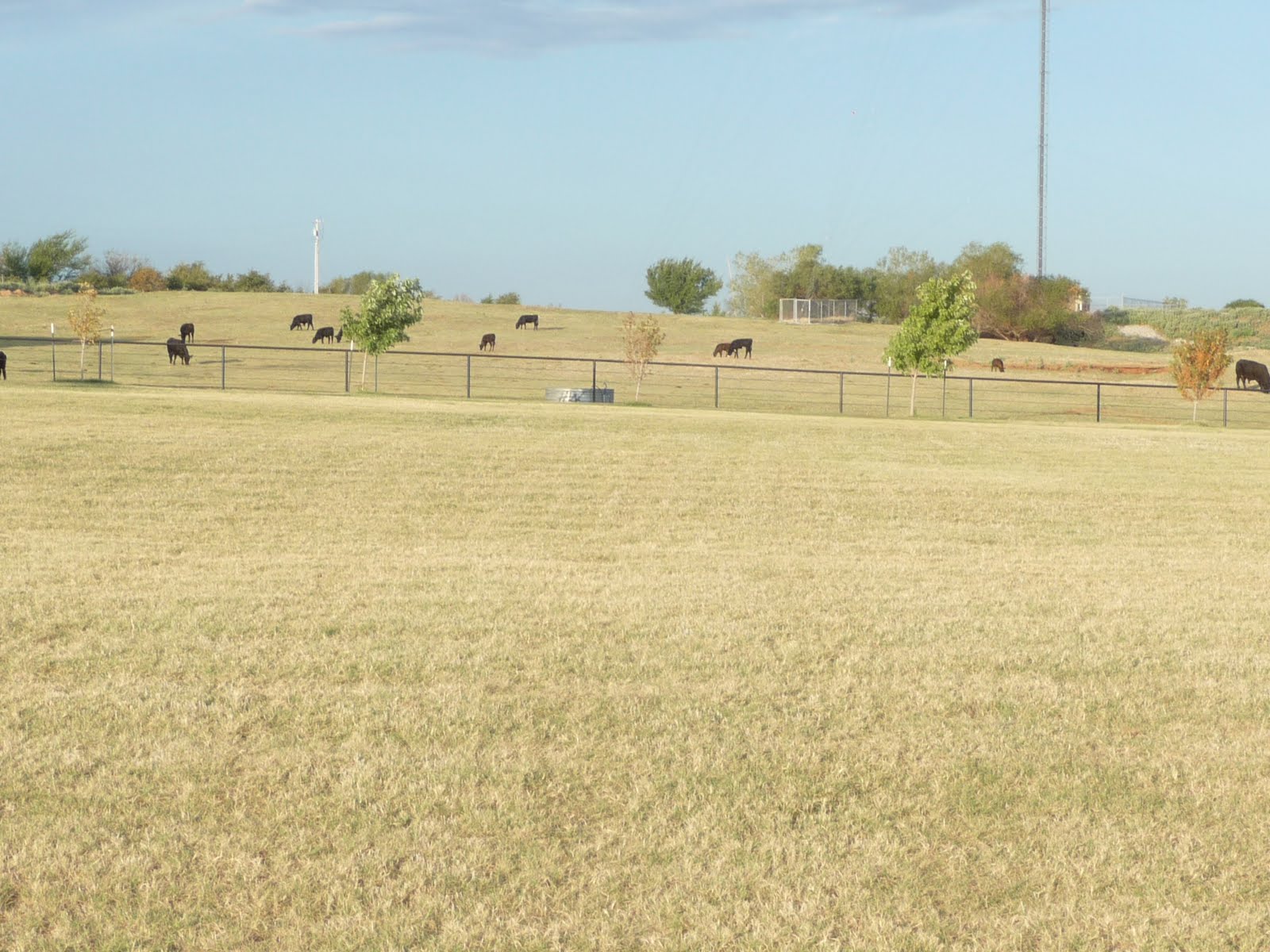 Some very nice farms along US 81. These ranchers have held on to some of their cattle as there is a bit of grass to graze upon. Many ranchers in Oklahoma and Texas have sold off their cattle because of the sever drought...no water in many places for well over one year...and the bit that does fall in passing storms - like the one last night - are so short in duration as to be not much benefit.
 Scenery along US 81 - Bypass.
 About 3 miles out from the Country Tavern, the wind kicked up to about 30 mph from behind me. When I turned around I was surprised to see the above weather front moving toward me...20 minutes ago the sky was blue with a few puffy clouds...how quickly things can change.
Luckily, it was moving South East and I did not get wet...but it was quite cold with the strong wind.
 A Ranch House on US 81.
 After returning to the Country Tavern, drove SPIA out about 12 miles and parked at the above Convenience Store / Gas Station. Walked another 10 miles - 5 out and 5 return.
Purchased a double Biscuit and Gravy - four biscuits under "flour" gravy @ $2.50...my early lunch for the day.
 US 81 at NINNEKAH, OKLAHOMA, where SPIA was parked.
 A derelict Barn...makes a nice vista against the distant background.
 A watering Pen (a very large metal Tub) for cattle...click click to enlarge.
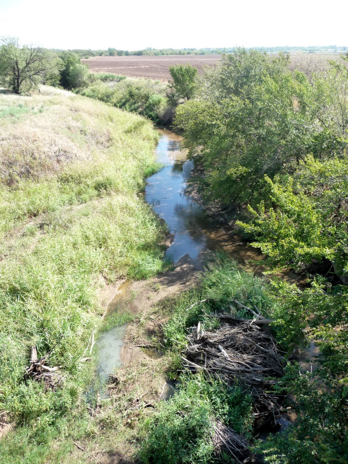 One of the few stream beds with running water. The water was about 4 inches deep and crystal clear.
 A Ranch Homestead on the hillside.
 US 81 looking North toward OKLAHOMA CITY, about 25 miles away and a bit to the right.
 Rolling Hills dominate this part of Oklahoma. A lot of stream beds without water, but with lines of Cottonwood Trees growing where the stream flows.
When looking for water, the dry stream bed lined with trees is a good place to do so. Find a soft spot and dig a bowl about 2 feet diameter and a foot or two deep...let set for a bit...water will often seep into the bowl. Use a dishcloth - or the shirt off your back - to soak up the water. Squeeze the cloth to get the water out. May taste a bit rough, but might just keep you alive.
 A picturesque Entrance Gate to the White Brothers Cattle Ranch.
 A Corn Field - after the Corn has been harvested. This field will soon be plowed / disc under to prepare for new planting...often a different crop to avoid depletion of minerals from the soil.
 A tree line following the path of a dry creek bed.
 Highway Maintenance Tractor / Mowers to keep the grass down. With the advent of state of the art Rotary Mowers, roadways all over America are now kept trimmed with this equipment.
 What the mowers miss, this crew uses Weed Eaters to get into the corners. Stopped to chat for a few minutes...was offered a job as they had an extra Weed Eater...I agreed, but they chickened out...had a few good laughs together.
 US 81 as it passes through the itty bitty town of POCASSET, OKLAHOMA, where SPIA is again tucked down next to the back wall of a local Convenience Store. Many thanks to Lalana "lana" and her mom, Doris for being so generous. Also met PG Grand Daughter (i.e., 4 generations of ladies, but failed to ask for a photograph)...Rats !
 POCASSET Community Center.
POCASSET is about 10 miles to the West of OKLAHOMA CITY, OKLAHOMA...

 US 81 is a 2-lane highway South of POCASSET, where I walked 10 miles this afternoon - for a total of 28 miles for the day -.
I show this particular spot because I was nearly hit by a pickup truck as it roared past me heading South - the direction we are looking - in the passing lane to the left. I was walking in the Parking Lane next to the White Line. I did not hear the truck coming as there were also other vehicles in the right-hand lane - which I DID hear.
This event was the second near miss within 20 minutes for me. A few weeks ago, I was crossing a narrow bridge across an Alabama Bayou when from behind me an Air Horn blasted...I recognized the horn as belonging to one of the logging trucks...many passed me every day...most of them toot tooted at me. This guy, however, kept tooting...finally holding down the horn as I realized with horror that he must be passing traffic while crossing the bridge. The vehicles...the truck...and I had no place to go. There was no side walk. The White Line was up against the concrete guard rail of the bridge.
Without looking back-I knew I had no time to look -, I threw one leg over the concrete guard rail and rolled flat onto the top of the rail...some 20 feet above a water-filled bayou below...as the truck, horn blasting all the time, flashed past me, not an inch or two away.
As it turned out, nobody was hurt. I wasn't even overly shook up. Crossing bridges is the most dangerous moment of walking and I anticipate my escape route at all times.
I was VERY lucky that time. I did not share it as I felt a bit foolish putting myself into danger like that...not to mention the mess if the truck had turned into the traffic it was passing.
So, I have used up at least 5 lives in such situations.
"Be Careful" everyone tells me...yes, I try to be careful. Then I remember that most accidents happen in or around the home...not out on the highway hundreds of miles from home. To be really careful, I would opt to stay sitting on the couch munching chips watching the tube...not my thing !
 When walking such curves, I often stay out of the "bottom" of the curve and walk the outside radius...it gives passing motorists more visibility to see me and more room to maneuver to miss me...also, I get more space to keep out of the way.
Reminds me of the moment in Oregon when the Logging Truck's Trailer cut the curve - far over the White Line - with me in the bottom of the curve. I was forced to jump completely off the roadway, rolling down a 15 foot embankment...it's on a prior Blog.
I ALWAYS seek out escape routes...even when there is no traffic...kinda like: I always expect the BEST...but have options ready if the WORST occurs.
 Salt Creek had a single puddle...a large creek but like so many I have walked over, DRY !
 Salt Creek Puddle.
 POCASSET, OKLAHOMA Church...just wonder where it gets all the people to fill up that overwhelming structure...cannot be more than 100 folks total in POCASSET.
 US 81 curving into POCASSET.
 A seldom seen fixture on America's roadways...a Collection Barrel for Trash...The 10 miles of US 81 from the City of CHICKASHA (prounced Chickash---long "a") and POCASSET has at least 20 such barrels.
This morning was quite cold...guessing at about 50-something. This afternoon, it got up into the upper 90s with lots of humidity...storm clouds are milling about...forecast is two more days of rain...in my estimation, we have had NO "rain". We have received a few drizzles, but as yet, no rain.
In the morning, SPIA again stays parked at Lana's. I will walk North on US 81 toward MINCO (8 miles away) and US 270, about 15 miles away. At US 270, we head Northwest about 70 miles to WOODWARD, OKLAHOMA. Looks like a Thursday, September 22 date to complete my current walk.
I am NOT looking forward to that ; I am rather enjoying myself out here.
No comments:
Post a Comment