
* * * * * * * * * *
Before presenting our maps for the State of Montana, a comment about MSN uploading of images...
Have tried all morning to upload the following few maps using MSN, with NO results.
Switched to MOZILLA FIREFOX...all maps uploaded within 5 minutes. Never hurts to shop around before putting too much effort into a purchase!
SAM and ME are presently in the city of DICKINSON, NORTH DAKOTA, some 60 miles from the MONTANA border. The next town is BELFIELD, NORTH DAKOTA; then comes MEDORA, North Dakota (at the THEODORE ROOSEVELT NATIONAL PARK, N.D.), which is 24 miles from the MONTANA border.
SAM and ME will be looking for a place to stay overnight in each of BELFIELD and MEDORA.
Recommendations may be forwarded to SAM and ME at our e-mail: moway35@aol.com.
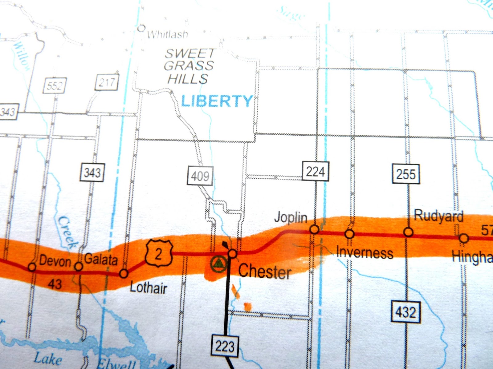
SAM and ME will also appreciate any help in finding places to stay in MONTANA, using the following maps to identify towns along our route.
Thank you, all, in advance for your assistance.
Maps may be enlarged by double-click on the image. Maps are aligned from EAST to WEST..

+TO+FRAZER...JPG)


+TO+E.+GLACIER..JPG)

+TO+TROY,+ID..JPG)
The final map brings us to IDAHO, where we will follow US Route 2 all the way to SPOKANE, Washington. At the town of WILBUR, we will switch to Route 174...then Route 17...then Route 153...and finally to Route 20, which takes us to MOUNT VERNON, Washington. We then hang a right on Route 9 to the Canadian Border...then take a left to BLAINE - and our final destination - THE PEACE ARCH.
It is a short and familiar walk of 25 miles from THE PEACE ARCH to my apartment in BELLINGHAM.
INJURY REPORT:
Except to walk to the restaurant across the street from the motel, I have stayed OFF my feet.
All open sores are now fully healed - yes, I heal FAST.
Have "iced" the Ankle injury most of today. It is still sensitive, but improving.
Both feet have been alternately in "ice water" bath most of today. Will continue with the ice water until bed time...and all day tomorrow. Seems to be MUCH better when I walked to SUBWAY for lunch (about 500 meters away).
Tomorrow evening, we should have a rather good indication as to whether it is wise to continue walking and rolling Sunday morning.
Revised current ETA (Estimated Time of Arrival) at THE PEACE ARCH is September 10, 2013.
2 comments:
Bruce
I am going to send you a message about potential hosts in Montana. Please check your email shortly.
Bruce,
If you use Google and put in the name of your town, Google maps should come up and right there on the map is a link for places to stay and motels. Like this:
for Medora, there's 6 places listed. (copy and paste the link below)
https://www.google.com/maps/preview#!q=motels&data=!4m22!1m9!4m8!1m3!1d8304!2d-103.5249145!3d46.9124424!3m2!1i1226!2i585!4f13.1!5m11!1m10!1smotels!4m8!1m3!1d8304!2d-103.5249145!3d46.9124424!3m2!1i1226!2i585!4f13.1
Also, if you click on 'directions', it will show you how many miles and you can even find out how to walk there and an approximate time.
Post a Comment